These three maps are all labelled as 2nd edition 1899. They cover the area Central Bampton, north & south, east nearly to Aston, Black Bourton south to Cowleaze Corner, east to Elephant & Castle in Bridge Street and Mt Owen Rd, west to road going up to Lew now called Station Road. They not only show the buildings but someone has written on in pencil when certain plots were sold and to whom. Interesting to see the clear fish-farming area with the Deanery then called Deanery Farm, Cobb House simply called Vicarage, Churchgate House called Trinity Vicarage. The third vicarage is today called Kilmore House and is almost opposite the East window of St. Mary's. What today is called Bridge Street was then called Mill Street and the mill was just to the left of path to Sandford Field from Bridge St. The legend is the mill wheel was buried in the plot to the left of the brook walking to the field from Bridge St and the tree there today was planted at its centre.
The map was produced in 1921. The first map is has been reused to show where council houses were to be built on the south side of New Road and where the sewerage pipes were to be laid to the sewerage works along the Buckland Road.
Mains sewerage came to Bampton in 1958 after a long struggle and at a cost of £105,000. Miss Marjorie Pollard was the driving force but in the end, it was the death of Horace Morse who emptied the 'night soil' buckets twice a week which made it imperative. Jack Bellinger was the first manager of the sewerage works.
These four maps were all produce in 1971 and cover
Ordinance Survey Plan SP3002-3102 Weald, Hayway Lane, Weald St, Clanfield Road Ordinance Survey Plan SP3003-3103. Bridge St east to end of houses, north to new school, Colvile Close Ordinance Survey Plan SP3203-3303. 1971 Mt Owen Rd east inc. Gogg Lane, Aston Rod to Aston Ordinance Survey Plan SP3002-3102 1971. Cowleaze Corner, Weald to Aston, north to Horse Shoe PH
Fields, property and farms are all clearly marked.
This map shows the Bampton Estates at 1789. This is before the fields were enclosed and the names of the people who farmed the strips or the name of the field area are on the map. The Quies fields are each side of the Bampton to Brize Norton road, just north of what is now Hobbs Buildings. The Clanfield to Bampton road is showing top to bottom on the map whereas it really runs east west, so you need to get your head around that, literally. What we now call Welcome Way is called Wiltham Way - it runs south from Cowleaze Corner into Weald. Weald Common Meadow was south of what we now think of as the area containing the two Bampton Business Parks. The Bampton to Buckland road is showing going left to right on the map when it actually runs NW to SE; it had a turnpike.
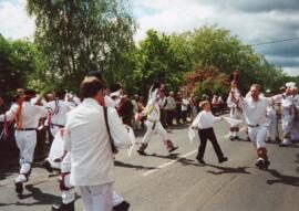
These are photographs of the Bampton Traditional Morris Men dancing on Spring Bank Holiday Monday in 2005. The visiting guest Morris sides are Abingdon and Leyland Morris.
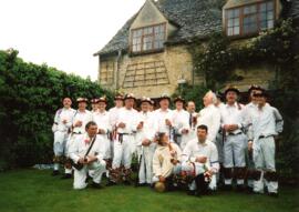
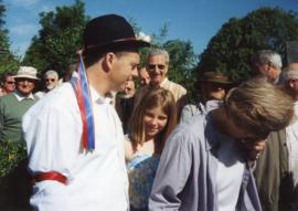
These pictures were taken by Bob West during the May Bank holiday weekend 1997. People in the pictures include Ann and Francis Shergold, Reg Hall, Craig Godwin, Jamie Blackwell and other members of the Francis Shergold side.
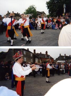
These photographs taken by Bob West record some of the activities of the late May Bank holiday weekend in 2000. Francis Shergold's morris side and visiting teams Sherbourne and Eynsham
These photographs, all taken by Bob West at the Spring Bank Holiday day of Morris Dancing 2000. All but the last two are Tony Daniels' morris side, (now at 2020 under Craig Godwin). The next to last picture is of Sherbourne Morris and the last picture is Eynsham Morris, both guests of the local side.