Showing 16 results

Archival description
Only top-level descriptions Weald
Print preview View:

16 results with digital objects Show results with digital objects

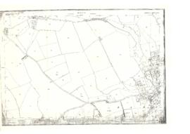
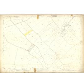
Map of Weald from Plantation south to Cowleaze Corner, east to the Elephant & Castle

  • BCA - 2020.2398
  • Item
  • 1921

This map of 1921 covers the area from Plantation south to Cowleaze Corner and east as far as the Elephant and Castle.

What was a watercourse off the Highmoor Brook to land with The Deanery can be clearly seen and was used for fish farming.

Cobb House is the only vicarage by now, the other two houses of the three-portion being in private hands, one Churchgate house the other now called Kilmore House.

Glebelands houses were not yet built, they didn't come until the 1960s.

The lake with Weald Manor House to its left used to freeze over and the owners of the Manor House used to invite locals to skate on it. Mr & Mrs Colvile lent the field to the west of the lake to the local football club but as it wasn't large enough for the side to play in a certain league, they had to find a new home and for a while used a field at the east end of New Road.

Bampton Community Archive

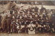
Weald Swifts Football Team 1926

  • BCA - 2023.4105
  • Item
  • 1926

Old Photograph showing the Weald Swifts Football Team in 1926 Names on photographs
Albert Townsend, Ted Townsend, John Tanner, Vic Tanner, Percy Shepherd, Bert Rouse, Ted Hunt, John Hunt, Freddie Lay,
Dick Butler, Dick Hunt, Tom Spurret, Bert Hunt, Chipney Wyatt, Joe Hirons, Brannon Brooks, Bobby Wells, Reg Tanner, Bill Hunt,
Billy Lindsey, Frank Tanner, Billy Wells, Son Townsend,

Janet Westman

A Lifetime of Farming by Don Rouse

  • BCA - 2023.4184
  • Item
  • 2011

Article written by Don Rouse about his life as a Farmer at Backhouse Farm in Weald. Starting in 1943, when he went with his dad Reg Rouse on the tractor and his memories of the land Army Girls and German Prisoners.

Janet Westman

1913 map of Weald, west to Marsh Lane on east edge of Clanfield

  • BCA - 2020.2394
  • Item
  • 1913

This map is from 1913 and covers the area from Marsh Lane on the eastern edge of Clanfield west across Weald. However, all of Bridge Street, half the Talbot Inn, the west side of the Market Square, the South side of Church Street and Church View are all in Weald and they are not shown here, possibly because the map was for agricultural purposes. There are some very interesting notes added in pencil.

Bampton Community Archive

Results 11 to 16 of 16