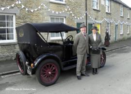
The makers of Downton Abbey invited local people to take part as extras. Doreen and Douglas Clare were delighted to be chosen each each from 2011 through 2015.
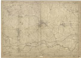
This map was produced in 1922 and shows the field system as well as the parliamentary boundaries as at 1918.
There are many interesting notes written on in pencil. The water tower and gas works along the Aston Road were in existence. The allotment gardens NW of Beam Cottage are labelled as is the gravel pit to the SW of Beam Cottage.
There are no houses to the north of New Road and none to the south of it going east from Bushey Row.
Rushy Weir is shown clearly as is the tow path to the south side of the river Thames.
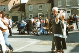
The photographs were all taken by Bob West who carried the cake for the Morris for very many years. They are all of the May Bank Holiday 1997 Morris Dancing