Showing 207 results

Archival description
Agriculture and Farming
Print preview View:

206 results with digital objects Show results with digital objects

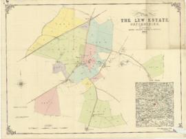
The Lew Estate 1914

  • BCA - 2020.2396
  • Item
  • 1914

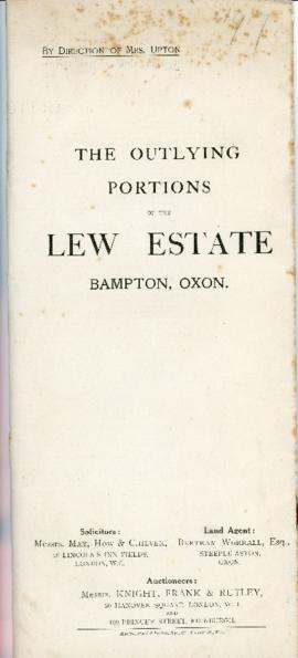
This map was produce for the sale of the Lew Estate in 1914.
There used to be a Post Office and a school in Lew, both shown on this map between University Farm and Holy Trinity Church on the main road.

Bampton Community Archive

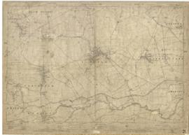
Bampton maps of 1921

  • BCA - 2020.2397
  • Item
  • 1921

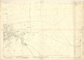
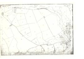
The map was produced in 1921. The first map is has been reused to show where council houses were to be built on the south side of New Road and where the sewerage pipes were to be laid to the sewerage works along the Buckland Road.

Mains sewerage came to Bampton in 1958 after a long struggle and at a cost of £105,000. Miss Marjorie Pollard was the driving force but in the end, it was the death of Horace Morse who emptied the 'night soil' buckets twice a week which made it imperative. Jack Bellinger was the first manager of the sewerage works.

Bampton Community Archive

Map of Weald from Plantation south to Cowleaze Corner, east to the Elephant & Castle

  • BCA - 2020.2398
  • Item
  • 1921

This map of 1921 covers the area from Plantation south to Cowleaze Corner and east as far as the Elephant and Castle.

What was a watercourse off the Highmoor Brook to land with The Deanery can be clearly seen and was used for fish farming.

Cobb House is the only vicarage by now, the other two houses of the three-portion being in private hands, one Churchgate house the other now called Kilmore House.

Glebelands houses were not yet built, they didn't come until the 1960s.

The lake with Weald Manor House to its left used to freeze over and the owners of the Manor House used to invite locals to skate on it. Mr & Mrs Colvile lent the field to the west of the lake to the local football club but as it wasn't large enough for the side to play in a certain league, they had to find a new home and for a while used a field at the east end of New Road.

Bampton Community Archive

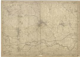
Ordnance Survey Map dated 1922 Grafton to Chimney including villages

  • BCA - 2022.3830
  • Item
  • 1922

Ordnance Survey Map Dated 1922. showing villages from Grafton Clanfield, Alvescot, Bampton south to Thames, Aston, Chimney
There are pencil notes on the map difficult to read'
The places printed on map are as follows
Bampton
Baptist Chapel
Beam Cottage
Bridge Street
Broad Street
Broad Street
Calais Farm
Castle remains
Cheapside
Church Lane
Churchgate House
Coalpit Farm
Deanery Farm
Elephant and Castle
Fishers Bridge
Gas Works
Ham Court
Highmoor Brook
Lady Well
Manor Cottage
Manor House
Mill Barn
Mill Bridge
Mount Owen Farm
New Inn Lane
Old Gravel Pit
Plantation
Primrose Cottages
Sandford Villa
Swan Inn
The Grange
Vicarage
Water Tower
Weald Manor House
Windmill House
Wrights hill
Lower Haddon Farm
Ven Bridge
Elmwood House

Alvescot
Alvescot House
Alvescot Lodge
Alvescot Mill
Alvescot Station
Bates Land Farm
Buxhill Farm
Manor Farm Alvescot
Milestone Road
Old Chapel Pit
Plough Inn
Rectory Farm
Red Lion PH
Royal George PH
Shield Farm
Smithy
St Peters Church
The Rectory
Vine Cottage

Clanfield
Little Clanfield
Grafton Green Farm
Little Clanfield Mill
Manor Farm

Radcot
Radcot New Buildings
Langley Lane
Langford Brook
Ashton Pill Bridge
Swan Inn
Cradle Bridge (Foot)
Radcot Bridge
River Thames
Entrenchment The Garrison
Towing Path
Radcot Lock
Sharney Brook
Burroway Brook
Burroway Bridge
Sharney Bridge
River Thames or Isis
Old Mans Bridge

Clanfield
Manor Farm
Broadwell Brook
Chestlion Farm
Clanfield Weir Farm
Engineering Work
Friar's Court Monastry
Pound Lane
St Stephens
Windmill Farm

Black Bourton
East Gloucestershire Branch Railway
Garsons Copse
High House
Manor Farm
Moat House
St Marys Church
Vicarage
Corn Mill
Lower Farm

Buckland Road
Boat House
Buckland Marsh
Great Brook
Isle of Wight Bridge
Meadow Farm
Tadpole Bridge
Tenfoot Bridge

Aston, Cote and Chimney
Aston House
Bull Inn
Bull Street
Cote House
Cote Lodge
Duckend Farm
Girls Training Home
Ham Lane
Kingsway Farm
North Street
Old Clay Pit
St James Church

Yelford
Claywell Farm
Elmbank
Manor Farm
Newhouse Farm
Rickless Hill
St Swithins Church
Yelford Manor
Ditcham Wood
Rushey Butts
Lew Lodge

Janet Westman

1922 map of Clanfield, Alvescot, Black Bourton, Grafton, Bampton, Aston, Cote & Chimney

  • BCA - 2020.2399
  • Item
  • 1922

This map was produced in 1922 and shows the field system as well as the parliamentary boundaries as at 1918.

There are many interesting notes written on in pencil. The water tower and gas works along the Aston Road were in existence. The allotment gardens NW of Beam Cottage are labelled as is the gravel pit to the SW of Beam Cottage.

There are no houses to the north of New Road and none to the south of it going east from Bushey Row.

Rushy Weir is shown clearly as is the tow path to the south side of the river Thames.

Bampton Community Archive

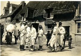
Morris Men outside the Elephant & Castle c1924

  • BCA - 2020.2338
  • Item
  • 1924 or 1925

Bampton Morris dancers c1924/5 outside the Elephant & Castle.

The sign over the pub door says Posting House, Horses, Carriages, Brakes. Personal attention given, Albert Townsend. The 3rd and 4th lines are hard to read which is a pity but it looks like 'For Hire All Trains Met On The Shortest Notice.

On 23rd September 1935 the Townsend family moved across the road to Castle View and made a farm of it having much more room to fatten more pigs.

Bampton Community Archive

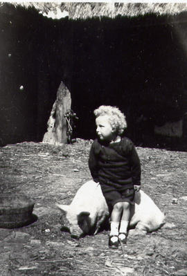
Dora Townsend sitting on a pig

  • BCA - 2021.3067
  • Item
  • 1927

Dora Townsend as a child sitting on a pig, 1927 when she lived at the Elephant and Castle. Her parents were Albert and Mary Elizabeth Townsend and she had older sister Ethel and Gladys and a brother Albert who was always known as either Son or Sonner

Nik Stanbridge

Results 31 to 40 of 207