Showing 50 results

Archival description
Bampton Community Archive With digital objects
Print preview View:
Map of Weald from Plantation south to Cowleaze Corner, east to the Elephant & Castle
Lew School and Post Office & Post Office Farm on a 1914 map
The Lew Estate 1914
The Lew Estate 1914
1913 map of Weald, west to Marsh Lane on east edge of Clanfield
2nd edition maps of 1899 Bampton, Black Bourton, Mt Owen Road
Map of 1797. Westwell east to Curbridge, Kemscott east to Coat Common plus St Giles Oxford
Map of Bampton Estate at 1789
Pre Inclosure map of Clanfield, Bampton, Aston & Yelford
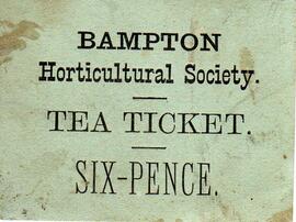
Tea ticket for Horticultural Society
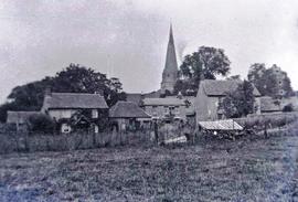
A view of St Mary's across Sandford Field
Results 41 to 50 of 50