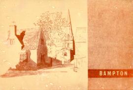
This report on the Survey & Plan of Bampton was done under the guidance of M W Robinson FRICS MTPI in October 1966. It makes very interesting reading and the conclusions are as relevant today as they were then. The topics covered are 1. Population 2. Situation 3. Character 4. The people 5. Shopping 6. Principal road connections 7. Schools 8. Open spaces 9. Social facilities, Public Services etc 10. Surface water drainage 11. Sewage disposal 12. Water supply and much more. It makes a very interesting read particularly in the light of all the dwellings that have been built here since October 1966, all those being built now (Jan 2017) and those being proposed when considering the access into Bampton has not been improved yet in 1966 one of the conclusions states was that Bampton could not take further development, a by-pass was not possible and no further space for parking other than possibly in Church Street could be made. Houses have since been built on the land in Church Street
Newspaper article about red Tape which stands between landowners and Environment Agency. Waterway Maintenance work to tackle flooding on land in west Oxfordshire
The map is pre Inclosure and covers Clanfield, Bampton, Aston and Yelford. The note with the Yelford map says it was from a map of 1624/5. A note at the right side of the page suggests all these details were pulled together from various sources in 1833 which is post Inclosure, which for the Bampton area was 1821. I can't work out what maps were used for the non-Yelford map but it says HHH is Aston 1771.
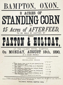
Poster dated August 18th 1890 advertising the auction of 8 acres of standing corn and 15 Acres of afterfield on Buckland Road. Auctioneers Paxton and Holiday to be held at The Talbot Hotel.
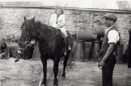
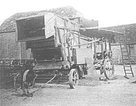
Series of Photographs taken early 1980 featuring some of the machinery on display. The photos are described as follows: BA40FA~1 - Ploughing with teams of 3 bullocks, young boy leading the front bullock and a ploughman on the reins. Each team pulled a single furrow plough. BA2357~1 - Mr Fred Hornsby at the front of the combine. Fred worked for John Henly on Bampton Deanery farm and in later years for his son Roy. This picture approximately 1980. BA0C0D~1 - Detail of a traction engine. There would have been one at opposite sides of the field and the implement, such as a plough or potato drill, would be pulled from side to side by the steel hawser seen here under the engine. The engine provided the power to turn the cable drum to wind in the cable. Originally the engine would have been fired by solid fuel but many were later converted to run on oil. BABDA1~1 - Douglas Read, OBE born 1926 taking part in a ploughing match. Doug got his MBE several years after this picture was taken and it was for services to ploughing. He has was national ploughing match champion more than once and in later years was a judge for the High Cut class at the Fairford, Faringdon, Filkins and Burford Ploughing Match. (Known to many locals as the 3Fs and a B). BA4883~1 - The driver of a plough being drawn across the field by a traction engine at the Fairford, Faringdon, Filkins and Burford Ploughing match.
Ordnance Survey Plan SP3002-3102 dated 1971. Cowleaze Corner, Weald to Aston, north to Horse Shoe and showing the following places and buildings Ashtree Aulnoy Backhouse Farm Bournemead Brook Farm Brook House Buckland Road Caravan Park Cheyne Lane Clanfield Road College Farm House Corner Farm Cowleaze Corner Cricket Field Dunlaoghaire Fisher's Bridge Gate Cottage Glebe Cottage Glebe Farm Ham Court Ham Court Cottages Highmoor House Knapps Farm Lime Tree Cottages Mill Bridge Mill Green Orchard Cottage Primrose Cottages Rose Cottage Shill Brook Shrangi-la Spring Cottages St Frideswide Stable Cottage Sunny view Sunnyside Thatch Cottage The Bungalow The Lodge The Old Farmhouse Weald Farm Weald Farm Cottages Weald Manor Weald Manor Cottage Weald Manor Farm