These three maps are all labelled as 2nd edition 1899. They cover the area Central Bampton, north & south, east nearly to Aston, Black Bourton south to Cowleaze Corner, east to Elephant & Castle in Bridge Street and Mt Owen Rd, west to road going up to Lew now called Station Road. They not only show the buildings but someone has written on in pencil when certain plots were sold and to whom. Interesting to see the clear fish-farming area with the Deanery then called Deanery Farm, Cobb House simply called Vicarage, Churchgate House called Trinity Vicarage. The third vicarage is today called Kilmore House and is almost opposite the East window of St. Mary's. What today is called Bridge Street was then called Mill Street and the mill was just to the left of path to Sandford Field from Bridge St. The legend is the mill wheel was buried in the plot to the left of the brook walking to the field from Bridge St and the tree there today was planted at its centre.
First of three Second Edition 1899 Ordnance Survey Maps showing Central Bampton, north & south, east nearly to Aston, Someone has annotated the map with pencil showing who owns various fields, and when bought and the cost. Names of people owning fields
Mr. Wilkins JG Andrews Trustees FF Southby Stevens of Calais Farm WW Shepherd Mr Rose Mr Carter Sold 18th May 1950 L H Saunders for £400 Sold 18th May 1950 Mr Read for £700 L Dafter Sold 18th May 1950 to F A Gerring for £2275
Places shown on Map in 1899 as follows: Beam Cottage Bridge Street Calais Farm Cheapside Church Street Fishers Bridge Manor Cottage Manor House New Inn Lane Primrose Cottages Swan Inn The Grange
Third of 3 Second Edition 1899 Ordnance Survey Maps Showing Mount Owen Road towards Lew. There are some pencil notes and some fields are coloured yellow. The following places are shown Lew Lodge Coalpit Farm Mount Owen Farm Ditcham Wood Rushey Butts
Second of three Second Edition 1899 Ordnance Survey Maps showing Black Bourton, Cowleaze Corner to Central Bampton and shows the following places Manor House Mill Bridge Millgreen Terrace New Inn Lane Plantation Sandford Villa Swan Inn The Grange Trinity Vicarage Weald Manor House
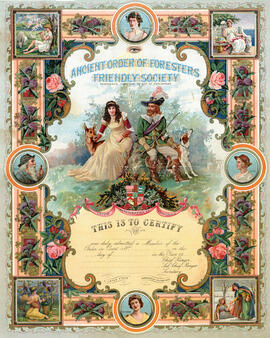
Beautiful Illustrated Certificate (unfilled) to Certify membership of Ancient Oder of Foresters Friend Society; Before our National Health System came into being in July 1948, people could pay a little each week into a club or Friendly Society and if they should find themselves unable to work through illness or accident.
Ted Dixey was known to most Bamptonians as a bellringer and Morris dancer. These are photograph of his maternal grandparents, his sister and husband Robert Ferguson, of Ted himself and his fiance of 40 years, Sylvia.
Black and White photograph of the Edginton Wedding group with some of the names. Robert Woodley Annie Butler Lena Edginton Albert Edginton Frank Woodley Em Hunt Beatrice Woodey Ada Butler (Tanner) Harry Bellinger