Showing 207 results

Archival description
Agriculture and Farming
Print preview View:

206 results with digital objects Show results with digital objects

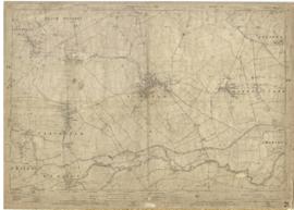
1922 map of Clanfield, Alvescot, Black Bourton, Grafton, Bampton, Aston, Cote & Chimney
The Lew Estate 1914
The Lew Estate 1914
Map with sale of Lower Haddon Farm March 1949
Lew School and Post Office & Post Office Farm on a 1914 map
Map of Bampton Estate at 1789
1974 OS map of Bampton and Aston
Four OS maps of Bampton 1971
Map with the sale of 5 residential and agricultural properties 1962
Map of Weald from Plantation south to Cowleaze Corner, east to the Elephant & Castle
Bampton maps of 1921
Results 191 to 200 of 207