- BCA - 2022.3782
- Item
- February 1977
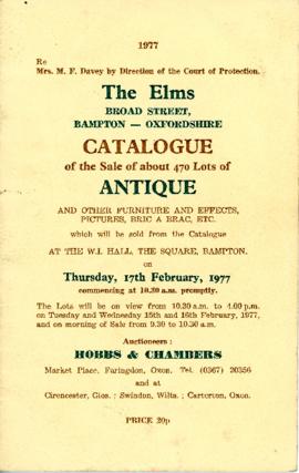
Catalogue of the contents of The Elms, Broad Street , being the belongings of Mrs Davey.
The catalogue was owned by Mrs K Jackson and is marked up with prices achieved.
Janet Westman
4137 results with digital objects Show results with digital objects
Catalogue of the contents of The Elms, Broad Street , being the belongings of Mrs Davey.
The catalogue was owned by Mrs K Jackson and is marked up with prices achieved.
Janet Westman
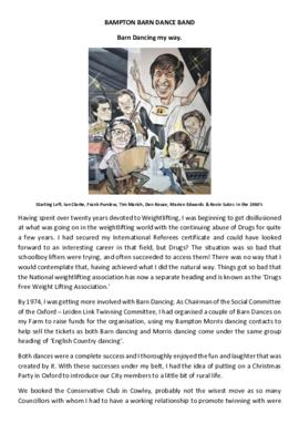
Bampton Barn Dance Band; Don Rouse, 40 years of running the band
For 40 years Don Rouse developed and ran a Barn Dance band which at one time ran hundreds of dances a year both in the UK and abroad, and all the while Don was running a dairy unit. This account is written by Don and apart from documenting the history of barn dancing for 40 years from 1974 it all co-incidentally wonderfully documents the changes in society that feel to have taken much of the fun out of life. It's a wonderful read for anyone interested in social history.
JANET Rouse
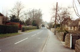
Photos Around Bampton in 1991 to 1992
Photographs supplied by Andrew Hilditch of views around Bampton
views of Aston Road, Floods in Mill Green, Ampney Orchard, Shiill Brook from Bridges, Mount Owen, Pavilion in Buckland Road,
Old farm house Weald Street, Primrose Cottages, St Mary's Trailer Park, RAF Bampton Aerials The Bridges Bridge Street, formerly called Mill Street, view of over field from Church Close
Janet Westman
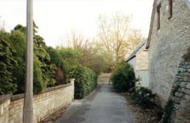
Photos of Alley ways and paths supplied by Andrew Hilditch
Path from The Pieces to Aston Road, Broad Street, west side, Queen St to Bushey Row path by Bampton House
Janet Westman
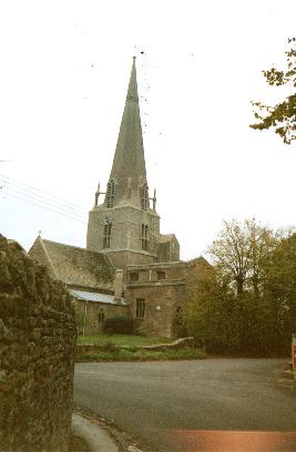
Images of Church Street Bampton 1988
View of Church Street including St. Marys , the Old Grammar School, (Vesey Rooms), Landells supplied by Andrew Hilditch in 1988
Janet Westman
Conveyance showing sale of land owned by Lime Tree Cottage, Weald in 1961 and a Statutory Declaration by Mrs EJ Hunt declaring ownership of the land and property. Also Plans showing the land referred to. Previous owners were Victor Charles Coombes and Richard Henry Owen. The sale was between Countess Munster and Charles Irwin Tighe of Highmoor House , Weald.
Janet Westman
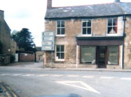
Images of Buildings in Market Square 1990
Images of Parkers Solicitors, now Marks Kitchen, (previously Constable's Bakery,) Rosemary House, and the Poachers Rest Restaurant (previously Barclays Bank) West end of Market Square
Supplied by Andrew Hilditch c 1990
Janet Westman

Map 1913 Edition Marsh Lane East incl Weald and Clanfield Road
Ordnance Survey Map showing Area from Marsh Lane, Weald and Clanfield Road,
used by Habgood and Mammatt Chartered Auctioneers and Estate Agents of Witney
Some Pencil markings showing land belonging to Parker, Abingdon Poor, Litchfield, Buckingham, Townsend, and "Little Weald" Auction 15/6/62.
Printed and published by Ordnance Survey Office Southampton 1913 Price 3/-
Janet Westman

Bampton at Time of the Enclosure Act 1821
These maps are copied from the document housed at St. Luke's Museum, in East Oxford. The Maps show The fish ponds and water courses, the areas of land and boundaries allocated to the Landowners and names of the plots. There are fish ponds marked in grey behind the Grange, by The Deanery, Weald Manor and down Cheyne Lane
Landowners are named as follows
Lord Shrewsbury, Jesus College, Miss CA Horde, H. Willis, L&T Dewe, James Dewe, The Revd G Richards, The Honourable J Coventry, H. Williams Lefsee, Abingdon Poor, Jos Andrews, Catherine Upjohn, Allotment for Tithes, The Dean and Chapter of Exeter, The Rev J Francis, Rev H Owen, W.J. Walker, Bernard Green, E. Whitaker, Josiah Andrews, G. Shingleton, Catherine Upjohn, Jos Barratt Esq, John Roberts , The Rev T Burrow, Swinbrook Charity, The Rev J Francis, John Kenn,
Names of Plots
Werge Furlong, Youngs Close, Pond Close, Cock, Hen and Chick Furlong, Burnthouse Closes, Bedsons Close, Lains Close, Wrights Hill Furlong, The Poor House, Pettifers Close, Kirks Close, Gravel Pits, The Bowling Green, Forty Acres, Grove Orchard, Dr Andrews, Forty Acres Furlong, Hawkins Piece, Lamperts Seven Acres, The Mews, Swinbrook Close, Home Orchard, Lower Orchard, Lissets Close, Fishers Bridge Close, Coppity Ground, Hows's Closes, Grove Orchard, Kirks Close, Clay Close, Little Clay, Landalls Mead, Calved Close, Dickinson Mead, Coneygra, Headland, Ten Acres F, Horse Close, The Knowl, Eight Acres, Barley ground, Eight Acre F, Gullivers Pieces, Rushey Close, Stray Close, Ham Court Orchard, Sandfords, Great Bourn, Watts Close, Bull Green, Furlong Shooting on Clanfield Footpath, Coxeters Furlong, Coxeter Piece, Varnells Furlong, Rake Ready Lane, Home Close, Spring Close, Bull Furlong, Thoroughout Furlong, Clay Furlong, Wright Hill Furlong, Home Orchard,
Janet Westman

Second Edition 1899. Ordnance Survey Map Central Bampton east towards Aston
First of three Second Edition 1899 Ordnance Survey Maps showing Central Bampton, north & south, east nearly to Aston, Someone has annotated the map with pencil showing who owns various fields, and when bought and the cost.
Names of people owning fields
Mr. Wilkins
JG Andrews Trustees
FF Southby
Stevens of Calais Farm
WW Shepherd
Mr Rose
Mr Carter
Sold 18th May 1950 L H Saunders for £400
Sold 18th May 1950 Mr Read for £700
L Dafter
Sold 18th May 1950 to F A Gerring for £2275
Places shown on Map in 1899 as follows:
Beam Cottage
Bridge Street
Calais Farm
Cheapside
Church Street
Fishers Bridge
Manor Cottage
Manor House
New Inn Lane
Primrose Cottages
Swan Inn
The Grange
Janet Westman