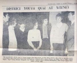
District Youth Quiz Bampton Team 1972
Add to clipboard
BCA - 2022.3940
Item
1970s
Newspaper cutting from Standard Times and Echo. Bampton team in the final
Janet Westman
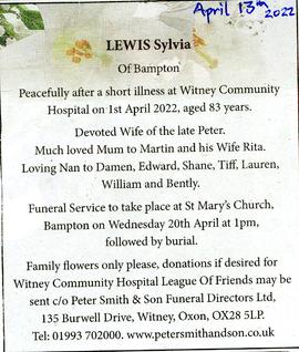
Death of Sylvia Lewis
Add to clipboard
BCA - 2022.3939
Item
12 April 2022
Newspaper Announcement of Sylvia Lewis (nee Dewe) death
Janet Westman
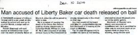
Death of Liberty Baker
Add to clipboard
BCA - 2022.3936
Item
2014
Newspaper cutting reporting death of Liberty Baker in Witney
Janet Westman
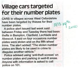
Number Plates Stolen
Add to clipboard
BCA - 2022.3935
Item
2020
Newspaper cutting reporting thefts of number plates in Bampton Clanfield, Lechlade and Alvescot
Janet Westman
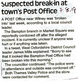
Break in at Post Office
Add to clipboard
BCA - 2022.3934
Item
2019
Newspaper cutting reporting the break in of the Post Office in the Town Hall
Janet Westman
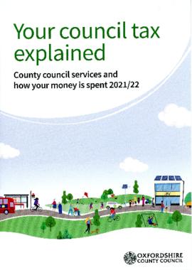
Council Tax Explained 2021/22
Add to clipboard
BCA - 2022.3933
Item
2021
Pamphlet from Oxfordshire County Council explaining how the council spends tax for 2021/22
Janet Westman
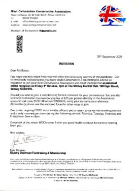
West Oxfordshire Conservative Association
Add to clipboard
BCA - 2022.3932
Item
2021
Letter to Ms Rouse from Kyle Thomas re membership of Conservative Party
Janet Westman
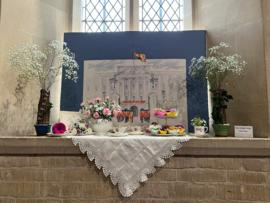
Clanfield Flower Festival
Add to clipboard
BCA - 2022.3930
Item
July 2022
46 images of beautiful flower arrangements in St Stephens Church Clanfield. to commemorate Queens 70th year on the throne.
Janet Westman