The Swan Sale Notice Page 2 & 3
- BCA - 2023.4433
- Item
- 2023
The Swan Sale Notice Page 2 & 3
Nik Stanbridge
458 results with digital objects Show results with digital objects
The Swan Sale Notice Page 2 & 3
The Swan Sale Notice Page 2 & 3
Nik Stanbridge
The Swan Conditions Of Sale 1964
The Swan Conditions Of Sale 1964
Nik Stanbridge
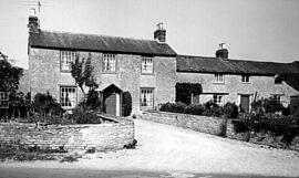
The Swan Buckland Rd Photo Ex Robert Colvile
The Swan Buckland Rd Photo Ex Robert Colvile
Nik Stanbridge
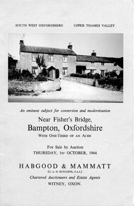
The Swan Buckland Rd Ex Robert Colvile
The Swan Buckland Rd Ex Robert Colvile
Nik Stanbridge

Plan of the Lew Estate, Oxfordshire divided into coloured sections/Lots for sale by auction by Messrs Knight, Frank and Rutley .
Janet Westman
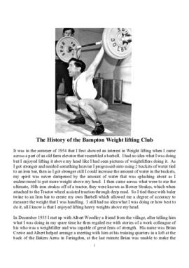
The History of the Bampton Weightlifting Club
A fascinating and amusing account of the history of The Bampton Weightlifting Club.
Janet Newman
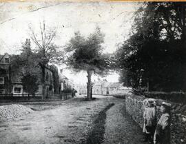
Old b/w photo of Broad Street, showing The Elms on the left, and Deanery Farm on the right, two little girls leaning against the wall on right hand side. No date.
Janet Westman
The Development of Printed Maps of Oxfordshire: From GOUGH to Google
In October 2012 the Bampton Environmental Watch Group had a wonderful talk given by John Leighfield on the history of maps and in particular maps of Oxfordshire and Bampton. It was very interesting to note that the first maps of Bampton showed the rivers and streams but no roads, showing the importance of waterways. It really is worth looking at the maps of Bampton carefully, you'll see just how old some buildings are, where the mill was in Bampton and Kerwoods Yard which was one area for the very poor with dwellings that had no land with them, they afforded the occupier a roof as opposed to 'the park bench' but no land on which to produce any food. It's referred to in early census forms and people come to Bampton asking where it is - it's on page 15 of this pdf
Bampton Community Archive
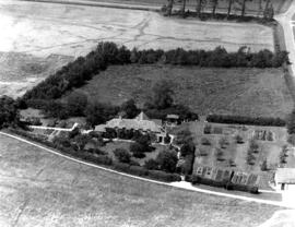
The Beam (Aerial View 1976) Kate Wylie & Dor Thompson
The Beam (Aerial View 1976) Kate Wylie & Dor Thompson
Nik Stanbridge