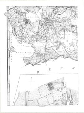
1797 Map showing Bampton Hundred
- BCA - 2022.3819
- Item
- 1797
Map showing Oxfordshire area from Westwell to Curbridge and Kelmscot to Coat (Cote) Common, Bampton Hundred,
plus segment showing St Giles, Oxford.
Published by R. Davis Lewknor August 1797 and indicating:
Alvescot, Asthrop Farm, Aston, Bampton and Aston Fields, Bampton in the Bush, Barley Park, Black Bourton, Brize Norton, Broadwell Grove, Broughton, Burwell Farm, Caswell, Clanfield, Clarks Wier, Claywell, Coat, Curbridge, David Wier, Ducklington, Ducklington, Eaton Hastings, Eaton Hastings, Friars Court, Grafton, Great Lemhill, Harts Wier, Holwell, Kelmscot, Kencote, Langfiord, Lew Barrow, Lew Barrow, Little Clanfield, March Haddon, Nans Wier, Nethber Filkins, New Mill, Ouseham Mill, Over Filkins, Oxley, Radcot, Rushey , Shill Farm, Shilton, Signet, Starvehall Farm, Sworn Leys, Tadpole and Bridge, Ten Foot Wier, Turnpike, Westwell, Witney Park, ,
Janet Westman

