Aston

Taxonomy

Code

Scope note(s)

Source note(s)

Display note(s)

Hierarchical terms

Aston

Equivalent terms

Aston

Associated terms

Aston

11 Archival description results for Aston

11 results directly related Exclude narrower terms

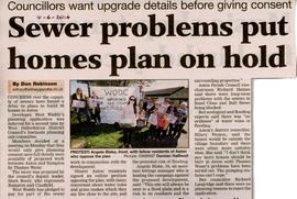
Downton Abbey Hospital Article in Aston Voices Magazine

  • BCA - 2023.4093
  • Item
  • 2022

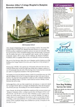
Article in the Voices Magazine produced in Aston, featuring The Old Grammar School and its role in the Downton Abbey series as the Cottage Hospital.
£400,000 was raised to renovate the old building which is now the Bampton Community Hub, and houses the Bampton Library, a gift shop and the Lewington Room.

Janet Westman

Evacuees to Bampton 1940 and Shirley Boyce's Memoir

  • BCA - 2022.3941
  • Item
  • 1940-43

Shirley Boyce was an Evacuee to Bampton during World War II and has written an account of her time in Bampton staying at a Manor House (Weald Manor?). Which had been divided into flats. She later stayed in Aston. The photo is of evacuated children from Bow, London playing in the grounds of Weald Manor in 1940. Two boys Kenny Howe and Leslie Tucker were billeted in New Road with Mr and Mrs Whighting?

Janet Westman

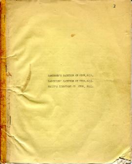
Gardener's ,Lascelles' and Kelly's Gazetteer 1982-1985

  • BCA - 2022.3848
  • Item
  • 1982-1985

Scanned copy of old document containing extracts from Gardener's Gazetteer of Oxon 1852, Lascelles' Gazetteer of Oxon 1853 and Kelly's Directory of Oxon 1895. Listing businesses and trades in Bampton and surrounding villages, and the following surnames are included
Adams
Andrews
Arkell
Baines
Baker
Bateman
Beckinsale
Beechey
Beresford
Biddulph
Bradshaw
Bryant
Bullem
Burrow
Butt
Carter
Chandler
Clack
Clifford
Clinch
Collins
Cook
Cook
Cowley
Cox
Coxeter
Cripps
Croft
Dewe
Dickens
Dipper
Dumbleton
Dutton
Edgington
Eldridge
Evans
Forest
Fox
Frampton
Francis
Frederick
Gerring
Giles
Gillet
Grove
Hambridge
Hardman
Harris
Holliday
Hollis
Hudson
Hutchings
Jackson
Jeeves
Jones
Knight
Lambeth
Leforestier
Long
Lord
Luckett
May
Miller
Newport
Oakey
Patt
Perkins
Pettyfer
Pinnock
Pinnocks
Plaster
Pnnock
Prior
Pusey
Reed
Richards
Robins
Rose and Bullen
Sellard
Shepherd
Smith
Southby
Sparrowhawk
Spiers
Spurret
Steede
Stevens
Stone
Swinburn
Taylor
Teall
Thompson
Townsend
Trafford
Vesey
Waite
Walker
Walsh
Ward
Werman
Whitaker
Widdows
Wilkins
Williams
Winstanley
Winterborne
Young 

Janet Westman

Ordnance Survey Map dated 1922 Grafton to Chimney including villages

  • BCA - 2022.3830
  • Item
  • 1922

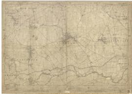
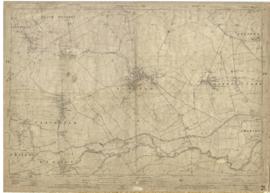
Ordnance Survey Map Dated 1922. showing villages from Grafton Clanfield, Alvescot, Bampton south to Thames, Aston, Chimney
There are pencil notes on the map difficult to read'
The places printed on map are as follows
Bampton
Baptist Chapel
Beam Cottage
Bridge Street
Broad Street
Broad Street
Calais Farm
Castle remains
Cheapside
Church Lane
Churchgate House
Coalpit Farm
Deanery Farm
Elephant and Castle
Fishers Bridge
Gas Works
Ham Court
Highmoor Brook
Lady Well
Manor Cottage
Manor House
Mill Barn
Mill Bridge
Mount Owen Farm
New Inn Lane
Old Gravel Pit
Plantation
Primrose Cottages
Sandford Villa
Swan Inn
The Grange
Vicarage
Water Tower
Weald Manor House
Windmill House
Wrights hill
Lower Haddon Farm
Ven Bridge
Elmwood House

Alvescot
Alvescot House
Alvescot Lodge
Alvescot Mill
Alvescot Station
Bates Land Farm
Buxhill Farm
Manor Farm Alvescot
Milestone Road
Old Chapel Pit
Plough Inn
Rectory Farm
Red Lion PH
Royal George PH
Shield Farm
Smithy
St Peters Church
The Rectory
Vine Cottage

Clanfield
Little Clanfield
Grafton Green Farm
Little Clanfield Mill
Manor Farm

Radcot
Radcot New Buildings
Langley Lane
Langford Brook
Ashton Pill Bridge
Swan Inn
Cradle Bridge (Foot)
Radcot Bridge
River Thames
Entrenchment The Garrison
Towing Path
Radcot Lock
Sharney Brook
Burroway Brook
Burroway Bridge
Sharney Bridge
River Thames or Isis
Old Mans Bridge

Clanfield
Manor Farm
Broadwell Brook
Chestlion Farm
Clanfield Weir Farm
Engineering Work
Friar's Court Monastry
Pound Lane
St Stephens
Windmill Farm

Black Bourton
East Gloucestershire Branch Railway
Garsons Copse
High House
Manor Farm
Moat House
St Marys Church
Vicarage
Corn Mill
Lower Farm

Buckland Road
Boat House
Buckland Marsh
Great Brook
Isle of Wight Bridge
Meadow Farm
Tadpole Bridge
Tenfoot Bridge

Aston, Cote and Chimney
Aston House
Bull Inn
Bull Street
Cote House
Cote Lodge
Duckend Farm
Girls Training Home
Ham Lane
Kingsway Farm
North Street
Old Clay Pit
St James Church

Yelford
Claywell Farm
Elmbank
Manor Farm
Newhouse Farm
Rickless Hill
St Swithins Church
Yelford Manor
Ditcham Wood
Rushey Butts
Lew Lodge

Janet Westman

Map of Aston & Bampton dated 1773 pre Inclosure Act

  • BCA - 2022.3817
  • Item
  • 1773

Hand drawn Map of showing fields and plots of land with their names in Weald, Bampton, Aston , Yelford and Shifford
The following plot names are included on the map: Aston Cow Common, Aston Sheep Common, Aston Way, Backrills, Badbury F, Bampton Wwstmoor Cow Common, Barnes F, Barow Laynes, Barrow Hill Furlong, Belham, Broad Close, Brook Eight Acres, Brookfast Furlong, Bush Furlong, Cabbage Mead, Calcraft Lane, Calcraft Paddocks, Calves Close, Carters Ham, Charney Meadow, Chimney, Church Field, Claye well Field, Clyell Furlong, Coae Moor Furlong, Coate Town, Columbine, Combe Hill Common, Corn Benny, Cornborn Mead, Cornburn Mead, Cottage Close or Cow Common, Cow Lease Furlong, Craze Acres, Cricklade Ham, Cripps F, Culvery F, Dales Middle East Hery, Dean Mill Furlong, Drove Close, Duxford East Hey, Esq Horde House, Farres First East Hey, Fore Mead, Fore Meadow, Fox Close, Foxes, Fross Furlong, Further Ash Close, Furths Edgerley F, Gander Fields, Garsons Field, Gaston Field, Green Close, Grafton Green, Grandmothers, Great Harnett Close, Great Hillingworth F, Great Nipham belonging to Duke of Marlbporough, Great Rushia, Green Benny F, Grrat Hell, Ham End Furlong, Hatchway Close, Hayway Furlong, Hesters Ground, Highmoor Meadow, Hilley Tithe, Hilly Lease, Holley Well Field, Home Covet, Home F, Home Rushia, Home Rushia, Kingsway Field, LaneCloses, Lanes Furlong, Langley Meadow, Laping Lands, Large Peece, Little Furzy, Little Harnett Close, Little Hell, Long Kendle , Long Lane, Long Sunderwell, Long Wood Furlong, Longlands Farm, Lower Bainey, Lower Cripps Piece, Marsh Long F, Mawbrook, May Furlong, Mead Furlong, Meadow or Elder Stump F, Middlefield, Mill F, Moor Furlong, Moors, Norloins, Oate F, Over Redlands, Pantins, Parsons Hedge Field, Perseland, Pissa Bed Furlong, Poulsworth Common Field, Pullins Piece, Rake Ready Lane, Redlands Farm, Rey Furlong, Rickley Hill, Rye Meadow, Shephouse Paddock, Shifford Common, Short Beer Furong, Short Hedge Furlong, Shortwood F, Shotton Fishermans Hedge, Showells Mead, Sidwell Close, Skinners F, Southby's Great East Hey, Spade Furlong, Sparkes Close, Spile Close, Stack Furlong, Stamps East Hey, Stocks Close, Stocks Lains F, Stone Acre, Swift Lake, Tanny Marsh, The Great Bourne, The Hakles, The Knoll, The Maths, Thirstle Reese, Thorney Lease, Town F, Turnpike Road, Upper Bainey and half Yard Mead, Upwell Grounds, Weed Furlong, Welshmans Acre, Westmoor Lane, Windmill, Wolands F, Wrights or Mill Field, Wymonds Place, Yard and half Mead, Youngs Close Furlong,

Janet Westman

A General View of Agriculture in Oxfordshire

  • BCA - 2022.3813
  • Item
  • 1813

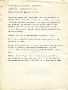
A general view of agriculture in Oxfordshire carried out in 1807 and published in 1813. Rates, thrashing mills and tillage. Drilling, wheat, beans and tares. Cattle and Labour. Relating to Bampton and its hamlets, Haddon, Weald, Cote, Aston, Lew, Chimney and Shifford. Report is written by Arthur Young and seems to use Mr. Singleton of Bampton as an example of of how things were done.

Janet Westman

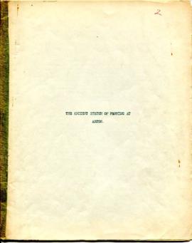
The Ancient System of Farming at Aston by Lloyd Hughes Owen

  • BCA - 2022.3767
  • Item
  • March 24th 1668

type written document by Lloyd Hughes Owen (Historian and Headmaster of Bampton School in 1950's), obviously transcribed from a vellum book written by Thomas Horde Esquire, Lord of the Manor of Aston and Cote in the parish of Bampton for the benefit of his tenants and landlords of Aston setting out the ancient farming system.

Janet Westman

1922 map of Clanfield, Alvescot, Black Bourton, Grafton, Bampton, Aston, Cote & Chimney

  • BCA - 2020.2399
  • Item
  • 1922

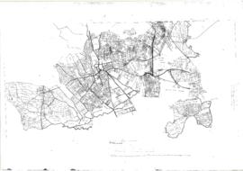
This map was produced in 1922 and shows the field system as well as the parliamentary boundaries as at 1918.

There are many interesting notes written on in pencil. The water tower and gas works along the Aston Road were in existence. The allotment gardens NW of Beam Cottage are labelled as is the gravel pit to the SW of Beam Cottage.

There are no houses to the north of New Road and none to the south of it going east from Bushey Row.

Rushy Weir is shown clearly as is the tow path to the south side of the river Thames.

Bampton Community Archive

Results 1 to 10 of 11