Showing 69 results

Archival description
Agriculture and Farming Text
Print preview View:

69 results with digital objects Show results with digital objects

Ordnance Survey Map dated  1922 Grafton to Chimney including villages
Ordnance Survey Map dated 1922 Grafton to Chimney including villages
Ordnance Survey Plan SP3002-3102 1971.    Cowleaze Corner  Weald to Aston Road
Ordnance Survey Plan SP3002-3102 1971. Cowleaze Corner Weald to Aston Road
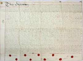
Indenture made May 10th 1808
Map of Aston & Bampton dated 1773 pre Inclosure Act
Bampton at Time of the Enclosure Act 1821
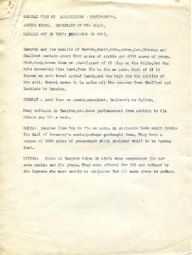
A General View of Agriculture in Oxfordshire
Map 1913 Edition  Marsh Lane East incl Weald and Clanfield Road
Map 1913 Edition Marsh Lane East incl Weald and Clanfield Road
The Ancient System of Farming  at Aston by Lloyd Hughes Owen
The Ancient System of Farming at Aston by Lloyd Hughes Owen
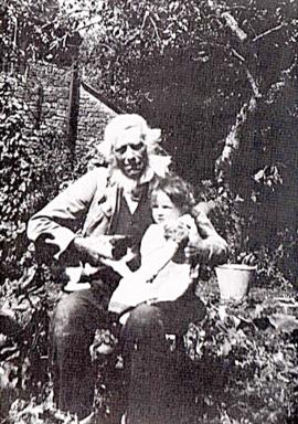
Shadrack 'Shepherd' Hayden 1829-1916
Well, now re-covered and inside the kitchen at Castle View (farmhouse)
Results 11 to 20 of 69