Identity area
Reference code
BCA - 2022.3829
Title
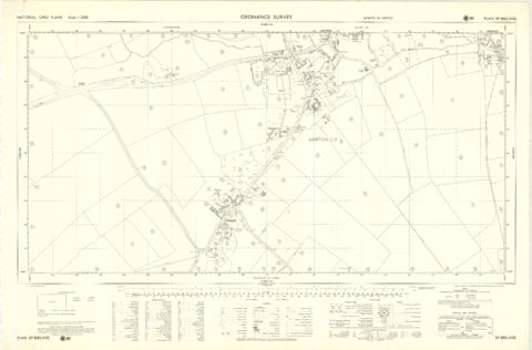
Ordnance Survey Plan SP3002-3102 1971. Cowleaze Corner Weald to Aston Road
Date(s)
- 1971 (Creation)
Level of description
Item
Extent and medium
PDF OS Map
Context area
Name of creator
Biographical history
Archival history
Immediate source of acquisition or transfer
Content and structure area
Scope and content
Ordnance Survey Plan SP3002-3102 dated 1971. Cowleaze Corner, Weald to Aston, north to Horse Shoe
and showing the following places and buildings
Ashtree
Aulnoy
Backhouse Farm
Bournemead
Brook Farm
Brook House
Buckland Road
Caravan Park
Cheyne Lane
Clanfield Road
College Farm House
Corner Farm
Cowleaze Corner
Cricket Field
Dunlaoghaire
Fisher's Bridge
Gate Cottage
Glebe Cottage
Glebe Farm
Ham Court
Ham Court Cottages
Highmoor House
Knapps Farm
Lime Tree Cottages
Mill Bridge
Mill Green
Orchard Cottage
Primrose Cottages
Rose Cottage
Shill Brook
Shrangi-la
Spring Cottages
St Frideswide
Stable Cottage
Sunny view
Sunnyside
Thatch Cottage
The Bungalow
The Lodge
The Old Farmhouse
Weald Farm
Weald Farm Cottages
Weald Manor
Weald Manor Cottage
Weald Manor Farm