Showing 462 results

Archival description
Bampton General
Print preview View:

455 results with digital objects Show results with digital objects

Second Edition 1899. Ordnance Survey Map Black Bourton, Cowleaze Corner east to Central Bampton
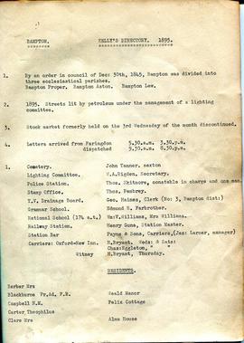
Kelly's Directory 1895
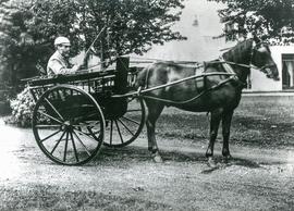
'Father and Dart' in 1890
The Development of Printed Maps of Oxfordshire: From GOUGH to Google
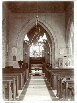
Restoration of St Mary The Virgin in 1870
Bampton at Time of the Enclosure Act 1821
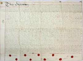
Indenture made May 10th 1808
1797 Map showing Bampton Hundred
Map of Bampton Estate at 1789
Map of Aston & Bampton dated 1773 pre Inclosure Act
Results 451 to 460 of 462