Showing 22 results

Archival description
Only top-level descriptions Weald
Print preview View:

22 results with digital objects Show results with digital objects

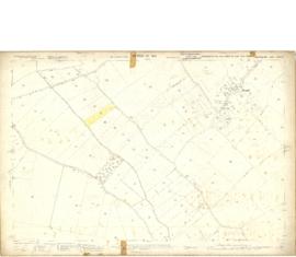
1913 map of Weald, west to Marsh Lane on east edge of Clanfield

  • BCA - 2020.2394
  • Item
  • 1913

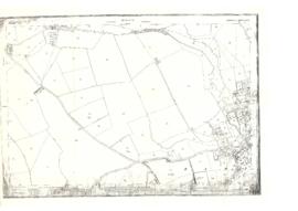
This map is from 1913 and covers the area from Marsh Lane on the eastern edge of Clanfield west across Weald. However, all of Bridge Street, half the Talbot Inn, the west side of the Market Square, the South side of Church Street and Church View are all in Weald and they are not shown here, possibly because the map was for agricultural purposes. There are some very interesting notes added in pencil.

Bampton Community Archive

Map of Weald from Plantation south to Cowleaze Corner, east to the Elephant & Castle

  • BCA - 2020.2398
  • Item
  • 1921

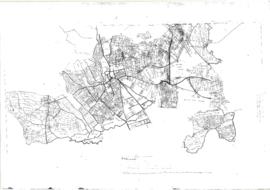
This map of 1921 covers the area from Plantation south to Cowleaze Corner and east as far as the Elephant and Castle.

What was a watercourse off the Highmoor Brook to land with The Deanery can be clearly seen and was used for fish farming.

Cobb House is the only vicarage by now, the other two houses of the three-portion being in private hands, one Churchgate house the other now called Kilmore House.

Glebelands houses were not yet built, they didn't come until the 1960s.

The lake with Weald Manor House to its left used to freeze over and the owners of the Manor House used to invite locals to skate on it. Mr & Mrs Colvile lent the field to the west of the lake to the local football club but as it wasn't large enough for the side to play in a certain league, they had to find a new home and for a while used a field at the east end of New Road.

Bampton Community Archive

Conveyance of South Terrace and Wedding Cert. Joan Willmer and Ernest Pocock

  • BCA - 2022.3808
  • Item
  • 1951

Marriage Certificate of Ernest Allen Pocock of Yew Tree Farm, Clanfield and Joan Barnard Willmer of Friars Court , Clanfield.
Their Fathers Allen William Pocock and Richard Newman Willmer were both farmers.
They married at the Methodist Chapel in Clanfield AR Hopkins, was Minister and Harry A Steptoe was Registrar. 1951.
Abstract of the title of Mrs Mary Elizabeth Willmer dated 1959 and Conveyance of South Terrace, Weald - a piece of land where a group of 6 cottages once stood.

Janet Westman

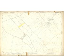
Map 1913 Edition Marsh Lane East incl Weald and Clanfield Road

  • BCA - 2022.3812
  • Item
  • 1913

Ordnance Survey Map showing Area from Marsh Lane, Weald and Clanfield Road,
used by Habgood and Mammatt Chartered Auctioneers and Estate Agents of Witney
Some Pencil markings showing land belonging to Parker, Abingdon Poor, Litchfield, Buckingham, Townsend, and "Little Weald" Auction 15/6/62.
Printed and published by Ordnance Survey Office Southampton 1913 Price 3/-

Janet Westman

A General View of Agriculture in Oxfordshire

  • BCA - 2022.3813
  • Item
  • 1813

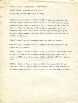
A general view of agriculture in Oxfordshire carried out in 1807 and published in 1813. Rates, thrashing mills and tillage. Drilling, wheat, beans and tares. Cattle and Labour. Relating to Bampton and its hamlets, Haddon, Weald, Cote, Aston, Lew, Chimney and Shifford. Report is written by Arthur Young and seems to use Mr. Singleton of Bampton as an example of of how things were done.

Janet Westman

Map of Aston & Bampton dated 1773 pre Inclosure Act

  • BCA - 2022.3817
  • Item
  • 1773

Hand drawn Map of showing fields and plots of land with their names in Weald, Bampton, Aston , Yelford and Shifford
The following plot names are included on the map: Aston Cow Common, Aston Sheep Common, Aston Way, Backrills, Badbury F, Bampton Wwstmoor Cow Common, Barnes F, Barow Laynes, Barrow Hill Furlong, Belham, Broad Close, Brook Eight Acres, Brookfast Furlong, Bush Furlong, Cabbage Mead, Calcraft Lane, Calcraft Paddocks, Calves Close, Carters Ham, Charney Meadow, Chimney, Church Field, Claye well Field, Clyell Furlong, Coae Moor Furlong, Coate Town, Columbine, Combe Hill Common, Corn Benny, Cornborn Mead, Cornburn Mead, Cottage Close or Cow Common, Cow Lease Furlong, Craze Acres, Cricklade Ham, Cripps F, Culvery F, Dales Middle East Hery, Dean Mill Furlong, Drove Close, Duxford East Hey, Esq Horde House, Farres First East Hey, Fore Mead, Fore Meadow, Fox Close, Foxes, Fross Furlong, Further Ash Close, Furths Edgerley F, Gander Fields, Garsons Field, Gaston Field, Green Close, Grafton Green, Grandmothers, Great Harnett Close, Great Hillingworth F, Great Nipham belonging to Duke of Marlbporough, Great Rushia, Green Benny F, Grrat Hell, Ham End Furlong, Hatchway Close, Hayway Furlong, Hesters Ground, Highmoor Meadow, Hilley Tithe, Hilly Lease, Holley Well Field, Home Covet, Home F, Home Rushia, Home Rushia, Kingsway Field, LaneCloses, Lanes Furlong, Langley Meadow, Laping Lands, Large Peece, Little Furzy, Little Harnett Close, Little Hell, Long Kendle , Long Lane, Long Sunderwell, Long Wood Furlong, Longlands Farm, Lower Bainey, Lower Cripps Piece, Marsh Long F, Mawbrook, May Furlong, Mead Furlong, Meadow or Elder Stump F, Middlefield, Mill F, Moor Furlong, Moors, Norloins, Oate F, Over Redlands, Pantins, Parsons Hedge Field, Perseland, Pissa Bed Furlong, Poulsworth Common Field, Pullins Piece, Rake Ready Lane, Redlands Farm, Rey Furlong, Rickley Hill, Rye Meadow, Shephouse Paddock, Shifford Common, Short Beer Furong, Short Hedge Furlong, Shortwood F, Shotton Fishermans Hedge, Showells Mead, Sidwell Close, Skinners F, Southby's Great East Hey, Spade Furlong, Sparkes Close, Spile Close, Stack Furlong, Stamps East Hey, Stocks Close, Stocks Lains F, Stone Acre, Swift Lake, Tanny Marsh, The Great Bourne, The Hakles, The Knoll, The Maths, Thirstle Reese, Thorney Lease, Town F, Turnpike Road, Upper Bainey and half Yard Mead, Upwell Grounds, Weed Furlong, Welshmans Acre, Westmoor Lane, Windmill, Wolands F, Wrights or Mill Field, Wymonds Place, Yard and half Mead, Youngs Close Furlong,

Janet Westman

Ordnance Survey PlanSP3002-3102 Weald, Hayway Lane, Weald St, Clanfield Rd. 1971

  • BCA - 2022.3824
  • Item
  • 1971

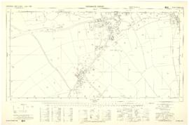
Ordnance Survey PlanSP3002-3102
extending from Weald, Hayway Lane, Weald St, Clanfield Rd. dated 1972 and showing the following properties and places:
Ashtree
Aulnoy
Backhouse Farm
Bournemead
Brook Farm
Brook Hoiuse
Buckland Road
Caravan Park
Cheyne Lane
Clanfield Road
College Farm House
Corner Farm
Cowleaze Corner
Dunlaoghaire
Fisher's Bridge
Gate Cottage
Glebe Farm
Ham Court
Ham Court Cottages
Highmoor House
Knapps Farm
Lime Tree Cottages
Mill Bridge
Mill Green
Orchard Cottage
Rose Cottage
Shill Brook
Shrangri-la
Spring Cottages
St Frideswide
Stable Cottage
Sunnyside
Thatch Cottage
The Old Farmhouse
Weald Farm
Weald Manor Cottage
Weald Manor
Weald Manor Farm

Janet Westman

Results 1 to 10 of 22