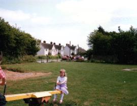
Playing Field in New Road 1988
- BCA - 2022.3804
- Item
- 1988
Image of young girl on seesaw in the Playing Field. New Road.
View shows houses in Bushey Row.
Adjacent to Fire Station, Field has been built over with Pembroke Close
Janet Westman
458 results with digital objects Show results with digital objects
Playing Field in New Road 1988
Image of young girl on seesaw in the Playing Field. New Road.
View shows houses in Bushey Row.
Adjacent to Fire Station, Field has been built over with Pembroke Close
Janet Westman
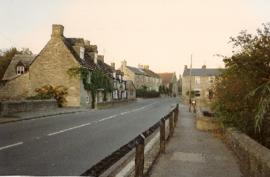
Images of Bridge Street in 1988 supplied by Andrew Hilditch
Janet Westman
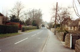
Photos Around Bampton in 1991 to 1992
Photographs supplied by Andrew Hilditch of views around Bampton
views of Aston Road, Floods in Mill Green, Ampney Orchard, Shiill Brook from Bridges, Mount Owen, Pavilion in Buckland Road,
Old farm house Weald Street, Primrose Cottages, St Mary's Trailer Park, RAF Bampton Aerials The Bridges Bridge Street, formerly called Mill Street, view of over field from Church Close
Janet Westman
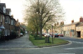
Views around Bampton supplied by Andrew Hilditch taken in 1988 showing Aston Road, Broad Street, Mercury Close, Cheapside Church Street., Bushey Road, Pococks Close
Janet Westman
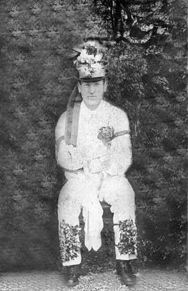
Philly Dewe Freda Bradley'S Grandfather
Philly Dewe Freda Bradley'S Grandfather
Nik Stanbridge
Pear Tree Cottage In Aston Road
Pear Tree Cottage In Aston Road
Nik Stanbridge
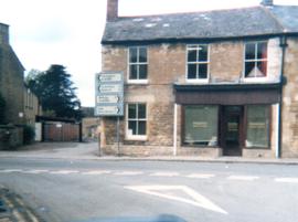
Part of Bampton in 1991: A photographic record by Andrew Hilditch
Tom Parker the solicitor had his premises here. From the late C19th it was Constables Bakery and today, 2022 it is the Chinese Take Away called Mark's Kitchen
Nik Stanbridge

Ordnance Survey PlanSP3002-3102 Weald, Hayway Lane, Weald St, Clanfield Rd. 1971
Ordnance Survey PlanSP3002-3102
extending from Weald, Hayway Lane, Weald St, Clanfield Rd. dated 1972 and showing the following properties and places:
Ashtree
Aulnoy
Backhouse Farm
Bournemead
Brook Farm
Brook Hoiuse
Buckland Road
Caravan Park
Cheyne Lane
Clanfield Road
College Farm House
Corner Farm
Cowleaze Corner
Dunlaoghaire
Fisher's Bridge
Gate Cottage
Glebe Farm
Ham Court
Ham Court Cottages
Highmoor House
Knapps Farm
Lime Tree Cottages
Mill Bridge
Mill Green
Orchard Cottage
Rose Cottage
Shill Brook
Shrangri-la
Spring Cottages
St Frideswide
Stable Cottage
Sunnyside
Thatch Cottage
The Old Farmhouse
Weald Farm
Weald Manor Cottage
Weald Manor
Weald Manor Farm
Janet Westman

Ordnance Survey Plan SP3203-3303. 1971 Mt Owen Rd east inc. Gogg Lane, Aston Road to Aston
Ordnance Survey Plan SP3203-3303. 1971 Extending from Mt Owen Rd east inc. Gogg Lane, Aston Road and part of Aston. showing the following places:
New Road
White Owl Farm
Bradshaw Close
Kenlincott
Kiln Close
Back Lane
Greenacres Lane
Elmside
Barry House
Ferndale
Back Cottage
Byeways
Laundry Lane
Kingsway Farm
High Street West End
The Limes
West End Farm
Home Farm House
Greens Row
Elvina
Aston Ditch
Mercury Close
Beam Cottage
Old Gasworks Building
New Road
The Willows
St Andrews
Janet Westman