Identity area
Reference code
BCA - 2022.3826
Title
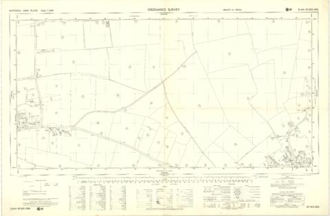
Ordnance Survey Plan SP3203-3303. 1971 Mt Owen Rd east inc. Gogg Lane, Aston Road to Aston
Date(s)
- 1971 (Creation)
Level of description
Item
Extent and medium
PDF of OS Map 1 page
Context area
Name of creator
Biographical history
Archival history
Immediate source of acquisition or transfer
Content and structure area
Scope and content
Ordnance Survey Plan SP3203-3303. 1971 Extending from Mt Owen Rd east inc. Gogg Lane, Aston Road and part of Aston. showing the following places:
New Road
White Owl Farm
Bradshaw Close
Kenlincott
Kiln Close
Back Lane
Greenacres Lane
Elmside
Barry House
Ferndale
Back Cottage
Byeways
Laundry Lane
Kingsway Farm
High Street West End
The Limes
West End Farm
Home Farm House
Greens Row
Elvina
Aston Ditch
Mercury Close
Beam Cottage
Old Gasworks Building
New Road
The Willows
St Andrews
Appraisal, destruction and scheduling
Accruals
System of arrangement
Conditions of access and use area
Conditions governing access
Conditions governing reproduction
Language of material
Script of material
Language and script notes
Physical characteristics and technical requirements
Finding aids
Allied materials area
Existence and location of originals
Existence and location of copies
Related units of description
Notes area
Alternative identifier(s)
Access points
Subject access points
Place access points
Name access points
Genre access points
Description control area
Description identifier
Institution identifier
Rules and/or conventions used
Status
Level of detail
Dates of creation revision deletion
Language(s)
Script(s)
Sources
Digital object metadata
Filename
Ordnance_Survey_Plan_SP3203-3303._1971_Mt_Owen_Rd_east_inc._Gogg_Lane__Aston_Rod_to_Aston.pdf
Latitude
Longitude
Media type
Text
Mime-type
application/pdf
Filesize
9.1 MiB
Uploaded
March 10, 2022 3:29 AM