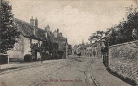
Picture postcard of the High Street looking east from outside the Grange. Addressed to Miss K Phillips in Stanton Harcourt. The New Inn and Pembrey's department store can be see with the steeple of St Mary The Virgin in the background.
The White family lived in Sandford Cottage, the thatched cottage on the south side of Sandford field from at least as early as 1900. These photographs cover the period 1910 to 1960. They are all family related, some babies, children, adults.
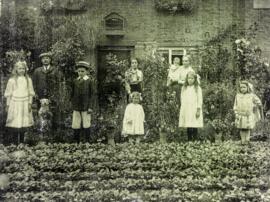
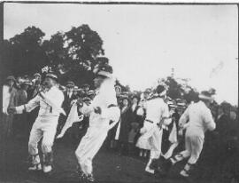
These photographs are very likely to have been taken in 1913. The fiddler dancing a jig to his own playing is William Nathan Wells, better known as Jingy.
Ordnance Survey Map showing Area from Marsh Lane, Weald and Clanfield Road, used by Habgood and Mammatt Chartered Auctioneers and Estate Agents of Witney Some Pencil markings showing land belonging to Parker, Abingdon Poor, Litchfield, Buckingham, Townsend, and "Little Weald" Auction 15/6/62. Printed and published by Ordnance Survey Office Southampton 1913 Price 3/-
This map is from 1913 and covers the area from Marsh Lane on the eastern edge of Clanfield west across Weald. However, all of Bridge Street, half the Talbot Inn, the west side of the Market Square, the South side of Church Street and Church View are all in Weald and they are not shown here, possibly because the map was for agricultural purposes. There are some very interesting notes added in pencil.
These are two parts of one map created in 1914. I've picked them out to show where the school used to be in Lew, next to University Farm and the Post Office a little to the east just before you get to Trinity Church.