Showing 24 results

Archival description
Item Maps With digital objects
Print preview View:

2nd edition maps of 1899 Bampton, Black Bourton, Mt Owen Road

  • BCA - 2020.2393
  • Item
  • 1899

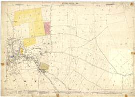
These three maps are all labelled as 2nd edition 1899. They cover the area Central Bampton, north & south, east nearly to Aston, Black Bourton south to Cowleaze Corner, east to Elephant & Castle in Bridge Street and Mt Owen Rd, west to road going up to Lew now called Station Road.
They not only show the buildings but someone has written on in pencil when certain plots were sold and to whom.
Interesting to see the clear fish-farming area with the Deanery then called Deanery Farm, Cobb House simply called Vicarage, Churchgate House called Trinity Vicarage. The third vicarage is today called Kilmore House and is almost opposite the East window of St. Mary's.
What today is called Bridge Street was then called Mill Street and the mill was just to the left of path to Sandford Field from Bridge St. The legend is the mill wheel was buried in the plot to the left of the brook walking to the field from Bridge St and the tree there today was planted at its centre.

Bampton Community Archive

Map with sale of Lower Haddon Farm March 1949

  • BCA - 2020.2404
  • Item
  • March 1949

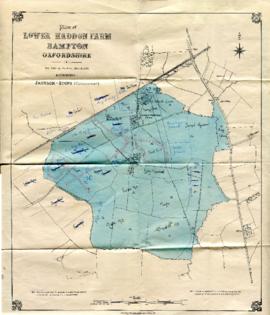
Lower Haddon Farm in the very north of the Bampton area was sold in March 1949. One of these maps was produced by Jackson-Stops of Cirencester the auctioneers and the other was a hand drawn one. They show the names of the fields and what was being grown in them at the time.

Bampton Community Archive

Map 1913 Edition Marsh Lane East incl Weald and Clanfield Road

  • BCA - 2022.3812
  • Item
  • 1913

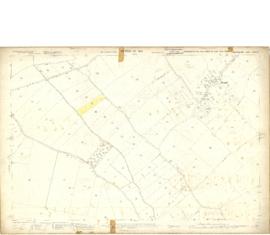
Ordnance Survey Map showing Area from Marsh Lane, Weald and Clanfield Road,
used by Habgood and Mammatt Chartered Auctioneers and Estate Agents of Witney
Some Pencil markings showing land belonging to Parker, Abingdon Poor, Litchfield, Buckingham, Townsend, and "Little Weald" Auction 15/6/62.
Printed and published by Ordnance Survey Office Southampton 1913 Price 3/-

Janet Westman

Bampton at Time of the Enclosure Act 1821

  • BCA - 2022.3816
  • Item
  • 1821

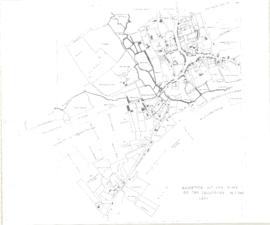
These maps are copied from the document housed at St. Luke's Museum, in East Oxford. The Maps show The fish ponds and water courses, the areas of land and boundaries allocated to the Landowners and names of the plots. There are fish ponds marked in grey behind the Grange, by The Deanery, Weald Manor and down Cheyne Lane
Landowners are named as follows
Lord Shrewsbury, Jesus College, Miss CA Horde, H. Willis, L&T Dewe, James Dewe, The Revd G Richards, The Honourable J Coventry, H. Williams Lefsee, Abingdon Poor, Jos Andrews, Catherine Upjohn, Allotment for Tithes, The Dean and Chapter of Exeter, The Rev J Francis, Rev H Owen, W.J. Walker, Bernard Green, E. Whitaker, Josiah Andrews, G. Shingleton, Catherine Upjohn, Jos Barratt Esq, John Roberts , The Rev T Burrow, Swinbrook Charity, The Rev J Francis, John Kenn,
Names of Plots
Werge Furlong, Youngs Close, Pond Close, Cock, Hen and Chick Furlong, Burnthouse Closes, Bedsons Close, Lains Close, Wrights Hill Furlong, The Poor House, Pettifers Close, Kirks Close, Gravel Pits, The Bowling Green, Forty Acres, Grove Orchard, Dr Andrews, Forty Acres Furlong, Hawkins Piece, Lamperts Seven Acres, The Mews, Swinbrook Close, Home Orchard, Lower Orchard, Lissets Close, Fishers Bridge Close, Coppity Ground, Hows's Closes, Grove Orchard, Kirks Close, Clay Close, Little Clay, Landalls Mead, Calved Close, Dickinson Mead, Coneygra, Headland, Ten Acres F, Horse Close, The Knowl, Eight Acres, Barley ground, Eight Acre F, Gullivers Pieces, Rushey Close, Stray Close, Ham Court Orchard, Sandfords, Great Bourn, Watts Close, Bull Green, Furlong Shooting on Clanfield Footpath, Coxeters Furlong, Coxeter Piece, Varnells Furlong, Rake Ready Lane, Home Close, Spring Close, Bull Furlong, Thoroughout Furlong, Clay Furlong, Wright Hill Furlong, Home Orchard,

Janet Westman

Results 21 to 24 of 24