Identity area
Reference code
Title
Date(s)
- 1899 (Creation)
Level of description
Item
Extent and medium
3 maps of 1899
Context area
Name of creator
Biographical history
Archival history
Immediate source of acquisition or transfer
Content and structure area
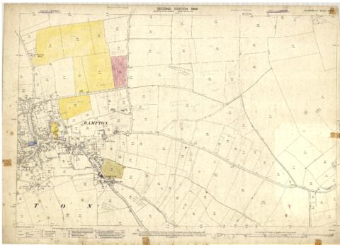
Scope and content
These three maps are all labelled as 2nd edition 1899. They cover the area Central Bampton, north & south, east nearly to Aston, Black Bourton south to Cowleaze Corner, east to Elephant & Castle in Bridge Street and Mt Owen Rd, west to road going up to Lew now called Station Road.
They not only show the buildings but someone has written on in pencil when certain plots were sold and to whom.
Interesting to see the clear fish-farming area with the Deanery then called Deanery Farm, Cobb House simply called Vicarage, Churchgate House called Trinity Vicarage. The third vicarage is today called Kilmore House and is almost opposite the East window of St. Mary's.
What today is called Bridge Street was then called Mill Street and the mill was just to the left of path to Sandford Field from Bridge St. The legend is the mill wheel was buried in the plot to the left of the brook walking to the field from Bridge St and the tree there today was planted at its centre.

