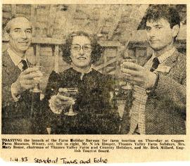
Celebrating the launch of the nationwide Farm Holiday Bureau are Mr Nick Hooper, Mrs Mary Rouse from Lew and Mr Dick Millard of the English Tourist Board. Nick and Mary were members of the local group, the Thames Valley Farm and Country Holiday group and were part of a small group of people from across the UK to set up the national organisation with included members in England, Wales, Scotland and N Ireland. Several years down the line the name was changed from Farm Holiday Bureau to Farm Stay UK. The launch was held at Cogges Farm in Cogges next to Witney.
The map was produced in 1921. The first map is has been reused to show where council houses were to be built on the south side of New Road and where the sewerage pipes were to be laid to the sewerage works along the Buckland Road.
Mains sewerage came to Bampton in 1958 after a long struggle and at a cost of £105,000. Miss Marjorie Pollard was the driving force but in the end, it was the death of Horace Morse who emptied the 'night soil' buckets twice a week which made it imperative. Jack Bellinger was the first manager of the sewerage works.
This Ordinance Survey map was produced in 1974 and covers the area from Hobbs buildings/Deanery Farm in the north, due east to Coal Pit Farm, south to Bampton centre, on south to Weald, east to Aston and south to the Radcot Cut and Great Brook and the Thames.
In October 2012 the Bampton Environmental Watch Group had a wonderful talk given by John Leighfield on the history of maps and in particular maps of Oxfordshire and Bampton. It was very interesting to note that the first maps of Bampton showed the rivers and streams but no roads, showing the importance of waterways. It really is worth looking at the maps of Bampton carefully, you'll see just how old some buildings are, where the mill was in Bampton and Kerwoods Yard which was one area for the very poor with dwellings that had no land with them, they afforded the occupier a roof as opposed to 'the park bench' but no land on which to produce any food. It's referred to in early census forms and people come to Bampton asking where it is - it's on page 15 of this pdf
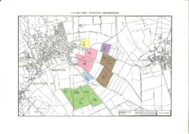
A PDF document of 9 pages detailing the sale of Calais Farm in 1984 by Moore, Allen and Innocent for Mr Bryan Stevens. About 185 acres freehold with vacant possession for sale by private treaty as a whole or in six lots
TOE2 is Oxfordshire’s independent environmental funder, supporting projects that make real and lasting improvements to the environment and to the lives of local people. TOE2, a charity and a notfor-profit company, has worked in partnership with OCC for several years to improve access to rights of way and green spaces across the county, supporting the aims of the Oxfordshire Rights of Way Improvement Plan
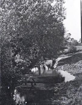
This peaceful scene is of an Ayrshire cow enjoying standing in the stream behind The Grange. It must have been taken fairly early in the twentieth century; by 1945 these cows were not often seen where they had once been bred
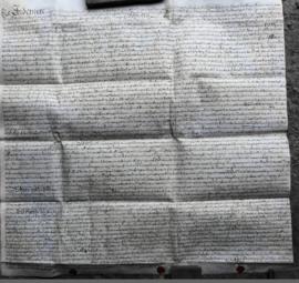
This Indenture on Vellum records :-A Release from William Thomas and Hester his Wife of Lands in Bampton Oxfordshire to Francis Sims Dated the Thirteenth day of June 1735.