Ordnance Survey Plan SP3203-3303. 1971 Extending from Mt Owen Rd east inc. Gogg Lane, Aston Road and part of Aston. showing the following places: New Road White Owl Farm Bradshaw Close Kenlincott Kiln Close Back Lane Greenacres Lane Elmside Barry House Ferndale Back Cottage
Byeways Laundry Lane Kingsway Farm High Street West End The Limes West End Farm Home Farm House Greens Row Elvina Aston Ditch Mercury Close Beam Cottage Old Gasworks Building New Road The Willows St Andrews
two maps - A Plan of Lower Hadden Farm from the Auction held in March 1949, and a hand drawn map of same area Auctioneers were Jackson-Stops (Cirencester) With hand written field names as follows Bampton Station Fairford to Oxford GWR Barnleys Pasture Big Barleys Big Row Black Bourton Road Bowlie Ground Bridle Path to Black Bourton Bridle Road Broad Close Cow Leas Far Hill Far Limber Front Field Furse Hill Harps Highmoor Brook Home Close Horn Ground James' Meadow Little Barleys Long Meadow Lower Hadden Farm Middle Hill Mill Barn Copse Near Barleys Near Limber Pike Ground Pond Gardens Rogers Meadow Rushey Row Smart Hill The Big Monk Water Meadows Willow Beds
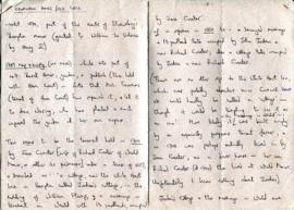
Handwritten notes by Hilda Kent, about the history of her home Cromwell House and the Old Forge. The tenants and owners from 1660's,, included Ann Waring Jane Coxeter John Fox John Jorden Messrs Orpwood and Smith Mrs Sammons Richard Coxeter Richard Sunderlands Thomas Sammons William Stamp