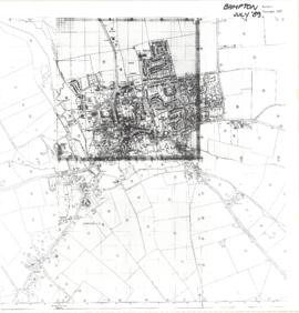
Map of Bampton July 1989 revised 1990
- BCA - 2022.3809
- Item
- 1989-1990
Map Showing extent of Bampton in1989 (revised 1990)
Janet Westman
Map of Bampton July 1989 revised 1990
Map Showing extent of Bampton in1989 (revised 1990)
Janet Westman
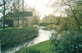
Highmoor Brook, also called Shill Brook 1991
Part of Bampton in 1991: A photographic record by Andrew Hilditch
This brook was originally called Highmoor brook but today people call it Shill brook. It is seen here from the Bridges on Bridge Street in 1991

Maps of East Half of Bampton 1921
3 Large ordnance Survey Maps used by Hadgood and Mammatt Auctioneers and Estate Agents from Witney. Published in 1921 price £5/- and £6/8d. Points of interest are Highmoor Brook, Plantation, Ham Court, Deanery Farm, Churchgate, Vicarage, Manor House, and Weald Manor House, old gravel pit and Beam Cottage, Calais Farm, Primrose Cottages, Fisher's Bridge
Janet Westman