Showing 13 results

Archival description
Bampton Community Archive Maps With digital objects
Print preview View:

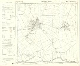
1974 OS map of Bampton and Aston

  • BCA - 2020.2402
  • Item
  • 1974

This Ordinance Survey map was produced in 1974 and covers the area from Hobbs buildings/Deanery Farm in the north, due east to Coal Pit Farm, south to Bampton centre, on south to Weald, east to Aston and south to the Radcot Cut and Great Brook and the Thames.

Bampton Community Archive

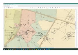
Lew School and Post Office & Post Office Farm on a 1914 map

  • BCA - 2020.2403
  • Item
  • 1914

These are two parts of one map created in 1914. I've picked them out to show where the school used to be in Lew, next to University Farm and the Post Office a little to the east just before you get to Trinity Church.

Bampton Community Archive

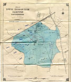
Map with sale of Lower Haddon Farm March 1949

  • BCA - 2020.2404
  • Item
  • March 1949

Lower Haddon Farm in the very north of the Bampton area was sold in March 1949. One of these maps was produced by Jackson-Stops of Cirencester the auctioneers and the other was a hand drawn one. They show the names of the fields and what was being grown in them at the time.

Bampton Community Archive

Results 11 to 13 of 13