The map is pre Inclosure and covers Clanfield, Bampton, Aston and Yelford. The note with the Yelford map says it was from a map of 1624/5. A note at the right side of the page suggests all these details were pulled together from various sources in 1833 which is post Inclosure, which for the Bampton area was 1821. I can't work out what maps were used for the non-Yelford map but it says HHH is Aston 1771.
This map of 1797 shows the Bampton Hundred and the fields. There is also a map of St Giles in Oxford at this time. Today, Kelmscott is spelt with two Ts but on this map it has one.
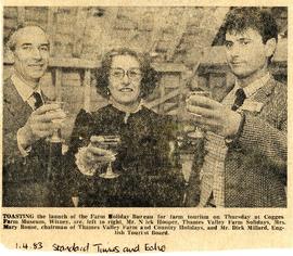
Celebrating the launch of the nationwide Farm Holiday Bureau are Mr Nick Hooper, Mrs Mary Rouse from Lew and Mr Dick Millard of the English Tourist Board. Nick and Mary were members of the local group, the Thames Valley Farm and Country Holiday group and were part of a small group of people from across the UK to set up the national organisation with included members in England, Wales, Scotland and N Ireland. Several years down the line the name was changed from Farm Holiday Bureau to Farm Stay UK. The launch was held at Cogges Farm in Cogges next to Witney.
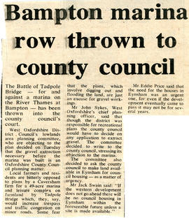
A Caversham firm want to make a 49 acre marina at Tadpole Bridge on the Thames. WODC lowlands area planning committee are objecting tot he plan because gravel extraction will have to take place first a marina could be built. The decision has been put into the hands of the County Council.
Now 2021 and no marina has been built or gravel extracted.