Identity area
Reference code
BCA - 2020.2392
Title
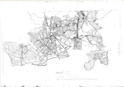
Pre Inclosure map of Clanfield, Bampton, Aston & Yelford
Date(s)
- 1624 (Creation)
Level of description
Item
Extent and medium
one map
Context area
Name of creator
Biographical history
Archival history
Immediate source of acquisition or transfer
Content and structure area
Scope and content
The map is pre Inclosure and covers Clanfield, Bampton, Aston and Yelford. The note with the Yelford map says it was from a map of 1624/5. A note at the right side of the page suggests all these details were pulled together from various sources in 1833 which is post Inclosure, which for the Bampton area was 1821. I can't work out what maps were used for the non-Yelford map but it says HHH is Aston 1771.