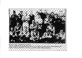
Bampton Town Football Club 1910-11 season
- BCA - 2019.2042
- Item
- 1910 1911
This old photograph shows the Bampton Town Football Club members in the 1910 to 1911 season.
Bampton Community Archive
3342 results with digital objects Show results with digital objects
Bampton Town Football Club 1910-11 season
This old photograph shows the Bampton Town Football Club members in the 1910 to 1911 season.
Bampton Community Archive
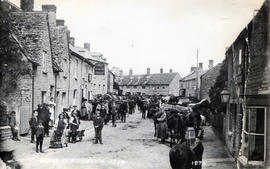
Horse fair outside the Wheat Sheaf on Bridge Street
The Horse Fair in Bridge Street looking east. At one time, it was one of the larger horse fairs in the country. Boys with barrows collected the horse dung for sale. The Wheatsheaf became the post office in 1972 and a private house in 2010 when the post office moved to the middle room of the Town Hall. The three semi-circular windows in the first floor of was the HSBC bank (in 2014) and Patrick Strainge butchers have been altered at some point to look like their neighbouring upstairs windows.
Nik Stanbridge
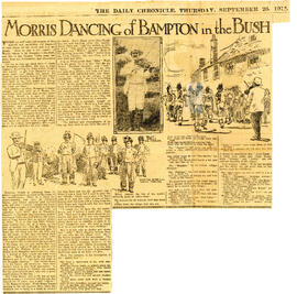
Morris Dancing in Bampton 1912
This newspaper sketch shows the fiddler Billy Wells - better known as Jingy Wells. Second from the left is Charles 'Cocky Tanner', the Bagman.Charles danced for forty years. At the back can be seen the Fool, Dave Edginton and at the front, extreme right, is Thomas 'Buscot' Tanner, the Squire.
Janet Newman
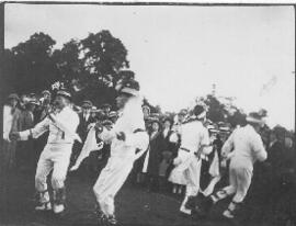
These photographs are very likely to have been taken in 1913. The fiddler dancing a jig to his own playing is William Nathan Wells, better known as Jingy.
Bampton Community Archive

Map 1913 Edition Marsh Lane East incl Weald and Clanfield Road
Ordnance Survey Map showing Area from Marsh Lane, Weald and Clanfield Road,
used by Habgood and Mammatt Chartered Auctioneers and Estate Agents of Witney
Some Pencil markings showing land belonging to Parker, Abingdon Poor, Litchfield, Buckingham, Townsend, and "Little Weald" Auction 15/6/62.
Printed and published by Ordnance Survey Office Southampton 1913 Price 3/-
Janet Westman

1913 map of Weald, west to Marsh Lane on east edge of Clanfield
This map is from 1913 and covers the area from Marsh Lane on the eastern edge of Clanfield west across Weald. However, all of Bridge Street, half the Talbot Inn, the west side of the Market Square, the South side of Church Street and Church View are all in Weald and they are not shown here, possibly because the map was for agricultural purposes. There are some very interesting notes added in pencil.
Bampton Community Archive
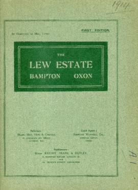
Sale brochure for The Lew Estate at 1914 by direction of Mrs Upton
Sale brochure for The Lew Estate at 1914 by direction of Mrs Upton
Nik Stanbridge

Plan of the Lew Estate, Oxfordshire divided into coloured sections/Lots for sale by auction by Messrs Knight, Frank and Rutley .
Janet Westman

Lew School and Post Office & Post Office Farm on a 1914 map
These are two parts of one map created in 1914. I've picked them out to show where the school used to be in Lew, next to University Farm and the Post Office a little to the east just before you get to Trinity Church.
Bampton Community Archive

This map was produce for the sale of the Lew Estate in 1914.
There used to be a Post Office and a school in Lew, both shown on this map between University Farm and Holy Trinity Church on the main road.
Bampton Community Archive