Showing 9 results
Archival description9 results with digital objects Show results with digital objects

Map of Aston & Bampton dated 1773 pre Inclosure Act
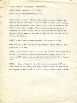
A General View of Agriculture in Oxfordshire

Map 1913 Edition Marsh Lane East incl Weald and Clanfield Road

1913 map of Weald, west to Marsh Lane on east edge of Clanfield

Map of Weald from Plantation south to Cowleaze Corner, east to the Elephant & Castle
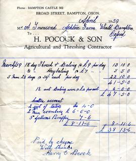
Invoice from Harry Pocock & Son, 1959
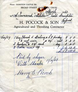
Invoice from Harry Pocock & Son, 19560

Ordnance Survey Plan SP3002-3102 1971. Cowleaze Corner Weald to Aston Road
A Lifetime of Farming by Don Rouse