Print preview Close

Showing 465 results

Archival description
Bampton General
Print preview View:

458 results with digital objects Show results with digital objects

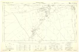
The Bampton Beam April 2003

  • BCA - 2021.2588
  • Item
  • 2003

The Bampton Beam used to be produce 3 times a year. This issue is from April 2003. The topics covered and the advertisers include:-ARTICLES AND NOTICESBampton’s Pre-School Playgroup – New Building Needed – Help Required!The Skate Park is Ready

Nik Stanbridge

Photos around Bampton 1988

  • BCA - 2022.3791
  • Part
  • 1988

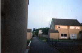
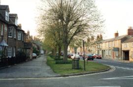
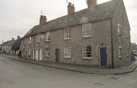
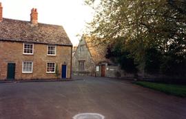
Views around Bampton supplied by Andrew Hilditch taken in 1988 showing Aston Road, Broad Street, Mercury Close, Cheapside Church Street., Bushey Road, Pococks Close

Janet Westman

Bampton School, Last days of Horsa Buildings

  • BCA - 2022.3798
  • Part
  • c1989

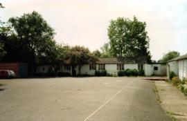
Series of Photos showing the last days of the Horsa Buildings annexed to The Old Bampton School Building. These were built in 1947, and were once The Canteen and Dining Room, The Domestic Science Block, The Woodworking Room, The Geography Room,
The Head Master's Office.

Janet Westman

Conveyance of South Terrace and Wedding Cert. Joan Willmer and Ernest Pocock

  • BCA - 2022.3808
  • Item
  • 1951

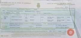
Marriage Certificate of Ernest Allen Pocock of Yew Tree Farm, Clanfield and Joan Barnard Willmer of Friars Court , Clanfield.
Their Fathers Allen William Pocock and Richard Newman Willmer were both farmers.
They married at the Methodist Chapel in Clanfield AR Hopkins, was Minister and Harry A Steptoe was Registrar. 1951.
Abstract of the title of Mrs Mary Elizabeth Willmer dated 1959 and Conveyance of South Terrace, Weald - a piece of land where a group of 6 cottages once stood.

Janet Westman

Maps of East Half of Bampton 1921

  • BCA - 2022.3814
  • Item
  • 1921

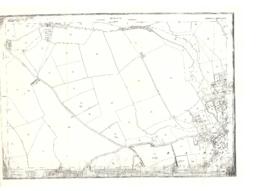
3 Large ordnance Survey Maps used by Hadgood and Mammatt Auctioneers and Estate Agents from Witney. Published in 1921 price £5/- and £6/8d. Points of interest are Highmoor Brook, Plantation, Ham Court, Deanery Farm, Churchgate, Vicarage, Manor House, and Weald Manor House, old gravel pit and Beam Cottage, Calais Farm, Primrose Cottages, Fisher's Bridge

Janet Westman

1797 Map showing Bampton Hundred

  • BCA - 2022.3819
  • Item
  • 1797

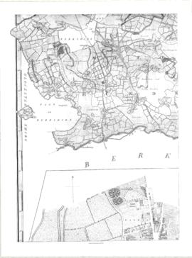
Map showing Oxfordshire area from Westwell to Curbridge and Kelmscot to Coat (Cote) Common, Bampton Hundred,
plus segment showing St Giles, Oxford.
Published by R. Davis Lewknor August 1797 and indicating:
Alvescot, Asthrop Farm, Aston, Bampton and Aston Fields, Bampton in the Bush, Barley Park, Black Bourton, Brize Norton, Broadwell Grove, Broughton, Burwell Farm, Caswell, Clanfield, Clarks Wier, Claywell, Coat, Curbridge, David Wier, Ducklington, Ducklington, Eaton Hastings, Eaton Hastings, Friars Court, Grafton, Great Lemhill, Harts Wier, Holwell, Kelmscot, Kencote, Langfiord, Lew Barrow, Lew Barrow, Little Clanfield, March Haddon, Nans Wier, Nethber Filkins, New Mill, Ouseham Mill, Over Filkins, Oxley, Radcot, Rushey , Shill Farm, Shilton, Signet, Starvehall Farm, Sworn Leys, Tadpole and Bridge, Ten Foot Wier, Turnpike, Westwell, Witney Park, ,

Janet Westman

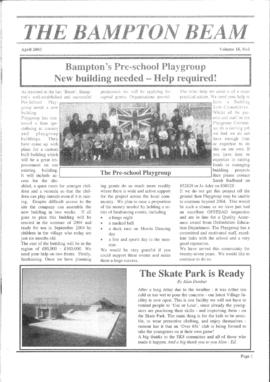
Ordnance Survey PlanSP3002-3102 Weald, Hayway Lane, Weald St, Clanfield Rd. 1971

  • BCA - 2022.3824
  • Item
  • 1971

Ordnance Survey PlanSP3002-3102
extending from Weald, Hayway Lane, Weald St, Clanfield Rd. dated 1972 and showing the following properties and places:
Ashtree
Aulnoy
Backhouse Farm
Bournemead
Brook Farm
Brook Hoiuse
Buckland Road
Caravan Park
Cheyne Lane
Clanfield Road
College Farm House
Corner Farm
Cowleaze Corner
Dunlaoghaire
Fisher's Bridge
Gate Cottage
Glebe Farm
Ham Court
Ham Court Cottages
Highmoor House
Knapps Farm
Lime Tree Cottages
Mill Bridge
Mill Green
Orchard Cottage
Rose Cottage
Shill Brook
Shrangri-la
Spring Cottages
St Frideswide
Stable Cottage
Sunnyside
Thatch Cottage
The Old Farmhouse
Weald Farm
Weald Manor Cottage
Weald Manor
Weald Manor Farm

Janet Westman

Results 131 to 140 of 465