Showing 4535 results

Archival description
With digital objects
Print preview View:
Maps of East Half of Bampton 1921
1797 Map showing Bampton Hundred
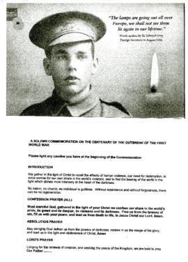
Service of Remembrance by the War Memorial August 4th 2014
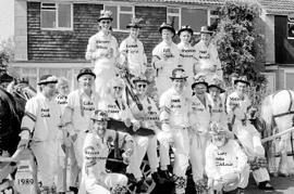
Bampton Morris Men, 1989 and 1999
Ordnance Survey PlanSP3002-3102 Weald, Hayway Lane, Weald St, Clanfield Rd. 1971
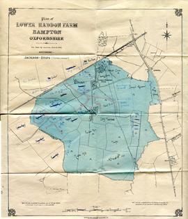
Maps with sale of Lower Haddon Farm 1949 1
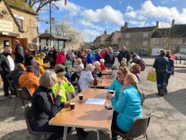
Sale for Ukrainian refugees
Ordnance Survey Map dated  1922 Grafton to Chimney including villages
Ordnance Survey Map dated 1922 Grafton to Chimney including villages
Second Edition 1899 Ordnance Survey Map Mt Owen Rd, west towards Lew
History of the SPAJERS in Bampton
Results 21 to 30 of 4535