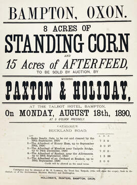
Poster selling Standing Corn
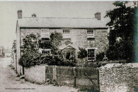
Castle View Farmhouse, c1880
The Development of Printed Maps of Oxfordshire: From GOUGH to Google
The Development of Printed Maps of Oxfordshire: From GOUGH to Google
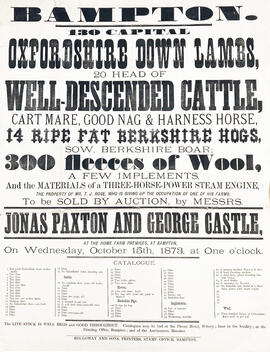
Farm Sales Poster - Oxfordshire Down Lambs etc

Bampton at Time of the Enclosure Act 1821

A General View of Agriculture in Oxfordshire
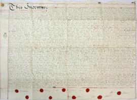
Indenture made May 10th 1808
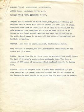
Agriculture in Bampton, Haddon, Weald, Cote, Aston, Lew, Chimney and Shifford (1807)

Map of 1797. Westwell east to Curbridge, Kemscott east to Coat Common plus St Giles Oxford

Map of Bampton Estate at 1789