Identity area
Reference code
BCA - 2020.2401
Title
Four OS maps of Bampton 1971
Date(s)
- 1971 (Creation)
Level of description
Item
Extent and medium
4 OS maps of Bampton 1971
Context area
Name of creator
Biographical history
Archival history
Immediate source of acquisition or transfer
Content and structure area
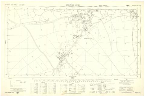
Scope and content
These four maps were all produce in 1971 and cover
Ordinance Survey Plan SP3002-3102 Weald, Hayway Lane, Weald St, Clanfield Road
Ordinance Survey Plan SP3003-3103. Bridge St east to end of houses, north to new school, Colvile Close
Ordinance Survey Plan SP3203-3303. 1971 Mt Owen Rd east inc. Gogg Lane, Aston Rod to Aston
Ordinance Survey Plan SP3002-3102 1971. Cowleaze Corner, Weald to Aston, north to Horse Shoe PH
Fields, property and farms are all clearly marked.