Print preview Close

Showing 3825 results

Archival description
With digital objects
Print preview View:
Ordnance Survey Map dated  1922 Grafton to Chimney including villages
Ordnance Survey Map dated 1922 Grafton to Chimney including villages
Ordnance Survey Plan SP3002-3102 1971.    Cowleaze Corner  Weald to Aston Road
Ordnance Survey Plan SP3002-3102 1971. Cowleaze Corner Weald to Aston Road
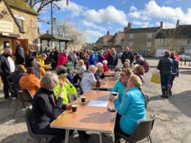
Sale for Ukrainian refugees
Lower Haddon Farm 1949 Auction Maps
Maps with sale of Lower Haddon Farm 1949 2
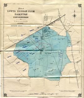
Maps with sale of Lower Haddon Farm 1949 1
Ordnance Survey Plan SP3203-3303. 1971 Mt Owen Rd east inc. Gogg Lane, Aston Road to Aston
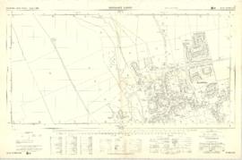
Ordnance Survey Plan SP3003-3103. Bridge St east Colvile Close etc 1971
Ordnance Survey PlanSP3002-3102 Weald, Hayway Lane, Weald St, Clanfield Rd. 1971
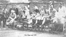
Shirt Races in 1955, c1965 and 1989
Results 2461 to 2470 of 3825