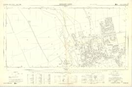
This Ordnance Survey Plan SP3003-3103. Dated 1971 shows area Bridge St east to end of houses, north to new school, Colvile Close etc Properties and Streets listed : Air Training Corps Ampney Lodge Apple Tree Cottage April Cottage Army cadet Hut Bakery Bampton House Bay Tree Cottage Belgrave Cottage Blackthorn Cottage Blackthorn Cottagre Bourton Cottage Box House Bushey House Calais Farm Cheapside Chestnuts Churchgate House Churchgate House Clevelly Cobb House Corner Cottage Cornmill Cotsway Cotswold Lodge Courtlands Dairy Farm House Deanery Farm Down Home Elephant and Castle Eton Villas Felix Cottage Fernlea Field Cottage Fishers Bridge Fleur de Lys Folly House Folly View Fox Close George and Dragon Grayshot House Ham Court Haytor House Highmoor Brook Inglenook Cottage Kilmore House Kilmore House Landells Leighton Cottage Lester House Library Lime Tree House Little Pinkneys Little Place Cottage Littlemead Lynton Mead Mallows Manor House Matthew House Melita Moss Rose Cottage Oathurst Estate Plantation Pococks Close Police Office Poplar Cottage Primrose Cottages Priory Cottage Prospect Cottage Prospect House Prospect Place Quebec Cottage Rhandom Roseann Rosebrook Rosemary House San Toy Sandford House Southrop House Southside St Johns House St Oswald Sunnyside Cottage Thatched Cottage The Bungalow The Deanery The Eagle The Elms The Gate Cottage The Glen The Grange The Grey House The Haven The Hermitage The Horse Shoe The Jubilee The Malt Shovel The Old Forge The Vicarage The Yews Town Hall Tudor Cottage Turnings Vaizey Cottage Vicarage Victoria Cottages Vine Cottage Weald Manor House Wheelgate House Windsmore Windsor Cottagres Yew Tree Cottage Youth Club Ampney Orchard Aston Road Bowling Green Close Bridge Street Broad Street Buckland Road Bushey Row Chandler Close Cheapside Church Lane Church Street Church View Colvile Close Glebelands High Street High Street Lavender Square Manor View Mercury Close New Road Queens Street Rosemary Lane
Ordnance Survey Plan SP3203-3303. 1971 Extending from Mt Owen Rd east inc. Gogg Lane, Aston Road and part of Aston. showing the following places: New Road White Owl Farm Bradshaw Close Kenlincott Kiln Close Back Lane Greenacres Lane Elmside Barry House Ferndale Back Cottage
Byeways Laundry Lane Kingsway Farm High Street West End The Limes West End Farm Home Farm House Greens Row Elvina Aston Ditch Mercury Close Beam Cottage Old Gasworks Building New Road The Willows St Andrews
The map is pre Inclosure and covers Clanfield, Bampton, Aston and Yelford. The note with the Yelford map says it was from a map of 1624/5. A note at the right side of the page suggests all these details were pulled together from various sources in 1833 which is post Inclosure, which for the Bampton area was 1821. I can't work out what maps were used for the non-Yelford map but it says HHH is Aston 1771.
Second of three Second Edition 1899 Ordnance Survey Maps showing Black Bourton, Cowleaze Corner to Central Bampton and shows the following places Manor House Mill Bridge Millgreen Terrace New Inn Lane Plantation Sandford Villa Swan Inn The Grange Trinity Vicarage Weald Manor House
First of three Second Edition 1899 Ordnance Survey Maps showing Central Bampton, north & south, east nearly to Aston, Someone has annotated the map with pencil showing who owns various fields, and when bought and the cost. Names of people owning fields
Mr. Wilkins JG Andrews Trustees FF Southby Stevens of Calais Farm WW Shepherd Mr Rose Mr Carter Sold 18th May 1950 L H Saunders for £400 Sold 18th May 1950 Mr Read for £700 L Dafter Sold 18th May 1950 to F A Gerring for £2275
Places shown on Map in 1899 as follows: Beam Cottage Bridge Street Calais Farm Cheapside Church Street Fishers Bridge Manor Cottage Manor House New Inn Lane Primrose Cottages Swan Inn The Grange
In October 2012 the Bampton Environmental Watch Group had a wonderful talk given by John Leighfield on the history of maps and in particular maps of Oxfordshire and Bampton. It was very interesting to note that the first maps of Bampton showed the rivers and streams but no roads, showing the importance of waterways. It really is worth looking at the maps of Bampton carefully, you'll see just how old some buildings are, where the mill was in Bampton and Kerwoods Yard which was one area for the very poor with dwellings that had no land with them, they afforded the occupier a roof as opposed to 'the park bench' but no land on which to produce any food. It's referred to in early census forms and people come to Bampton asking where it is - it's on page 15 of this pdf
This map was produce for the sale of the Lew Estate in 1914. There used to be a Post Office and a school in Lew, both shown on this map between University Farm and Holy Trinity Church on the main road.