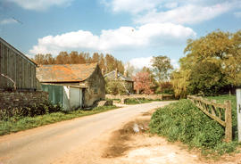
Milk churn stand outside Weald Farm, Weald Street
- BCA - 2021.3176
- Item
- 2021
Milk churn stand outside Weald Farm, Weald Street
Nik Stanbridge
208 results with digital objects Show results with digital objects
Milk churn stand outside Weald Farm, Weald Street
Milk churn stand outside Weald Farm, Weald Street
Nik Stanbridge
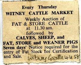
Newspaper clipping advertising the weekly cattle market held in Witney
Newspaper clipping from the Witney Gazette April 4th 1958 advertising the weekly cattle market held in Witney
Nik Stanbridge
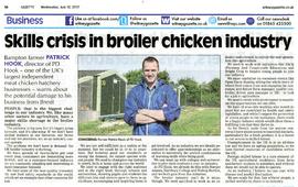
Patrick Hook, director of PD Hook
Patrick Hook, director of PD Hook
Nik Stanbridge
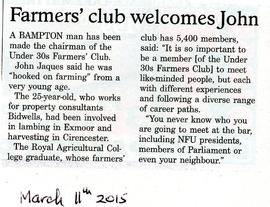
John Jaques from Bampton has been made chairman of the Under 30s Farmers' Club.
Witney Gazette March 11th 2015. John Jaques from Bampton has been made chairman of the Under 30s Farmers' Club.
Nik Stanbridge

Pre Inclosure map of Clanfield, Bampton, Aston & Yelford
The map is pre Inclosure and covers Clanfield, Bampton, Aston and Yelford. The note with the Yelford map says it was from a map of 1624/5. A note at the right side of the page suggests all these details were pulled together from various sources in 1833 which is post Inclosure, which for the Bampton area was 1821. I can't work out what maps were used for the non-Yelford map but it says HHH is Aston 1771.
Bampton Community Archive

Map of Weald from Plantation south to Cowleaze Corner, east to the Elephant & Castle
This map of 1921 covers the area from Plantation south to Cowleaze Corner and east as far as the Elephant and Castle.
What was a watercourse off the Highmoor Brook to land with The Deanery can be clearly seen and was used for fish farming.
Cobb House is the only vicarage by now, the other two houses of the three-portion being in private hands, one Churchgate house the other now called Kilmore House.
Glebelands houses were not yet built, they didn't come until the 1960s.
The lake with Weald Manor House to its left used to freeze over and the owners of the Manor House used to invite locals to skate on it. Mr & Mrs Colvile lent the field to the west of the lake to the local football club but as it wasn't large enough for the side to play in a certain league, they had to find a new home and for a while used a field at the east end of New Road.
Bampton Community Archive

Map with the sale of 5 residential and agricultural properties 1962
This map was produce by Morre, Allan and Innocent to accompany the sale for 5 residential and agricultural properties May 14th 1962. They are all east and south east of Bampton's main residential area.
Lot 1 is Meadow Farm
Lot 2 is to the north of the Aston road and include Ampney Lodge
Lot 3 is a strip with Calais farm
Lot 4 is a field approximately where Bampton Garden Centre is today
Love 5 is a group of fields to the south of the Great Brook
Bampton Community Archive

These four maps were all produce in 1971 and cover
Ordinance Survey Plan SP3002-3102 Weald, Hayway Lane, Weald St, Clanfield Road
Ordinance Survey Plan SP3003-3103. Bridge St east to end of houses, north to new school, Colvile Close
Ordinance Survey Plan SP3203-3303. 1971 Mt Owen Rd east inc. Gogg Lane, Aston Rod to Aston
Ordinance Survey Plan SP3002-3102 1971. Cowleaze Corner, Weald to Aston, north to Horse Shoe PH
Fields, property and farms are all clearly marked.
Bampton Community Archive

Lew School and Post Office & Post Office Farm on a 1914 map
These are two parts of one map created in 1914. I've picked them out to show where the school used to be in Lew, next to University Farm and the Post Office a little to the east just before you get to Trinity Church.
Bampton Community Archive