Showing 1600 results

Archival description
Text With digital objects
Print preview View:
Map with the sale of 5 residential and agricultural properties 1962
Map of Weald from Plantation south to Cowleaze Corner, east to the Elephant & Castle
Bampton maps of 1921
1913 map of Weald, west to Marsh Lane on east edge of Clanfield
2nd edition maps of 1899 Bampton, Black Bourton, Mt Owen Road
Pre Inclosure map of Clanfield, Bampton, Aston & Yelford
Map of 1797. Westwell east to Curbridge, Kemscott east to Coat Common plus St Giles Oxford
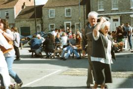
May Bank Holiday weekend 1997
Ann & Francis Shergold & brother Roy Shergold 1999
May Bank Holiday weekend May 2000
Results 1541 to 1550 of 1600