
Sales brochure for Lower Haddon Farm March 11th 1949
- BCA - 2021.3137
- Item
- 1949
Sales brochure for Lower Haddon Farm March 11th 1949
Nik Stanbridge
69 results with digital objects Show results with digital objects
Sales brochure for Lower Haddon Farm March 11th 1949
Sales brochure for Lower Haddon Farm March 11th 1949
Nik Stanbridge
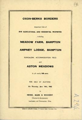
Sale brochure: Meadow farm; Ampney Lodge; Bungalow; Pasture field; Aston Meadows. June 14th 1962
Sale brochure: Meadow farm; Ampney Lodge; Bungalow; Pasture field; Aston Meadows. June 14th 1962
Nik Stanbridge
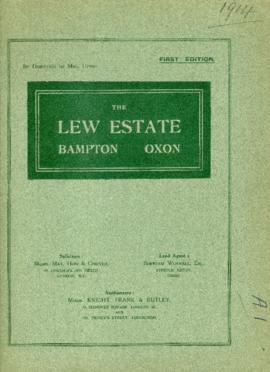
Sale brochure for The Lew Estate at 1914 by direction of Mrs Upton
Sale brochure for The Lew Estate at 1914 by direction of Mrs Upton
Nik Stanbridge
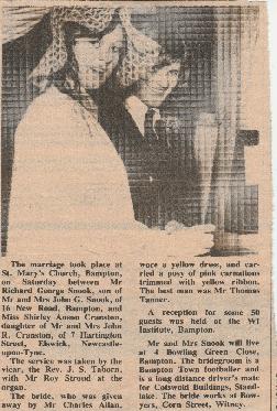
These newspaper cuttings, all from local papers are from 1972. Topics covered include:
Bampton Community Archive
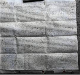
This Indenture on Vellum records :-A Release from William Thomas and Hester his Wife of Lands in Bampton Oxfordshire to Francis Sims Dated the Thirteenth day of June 1735.
Bampton Community Archive

Map with sale of Lower Haddon Farm March 1949
Lower Haddon Farm in the very north of the Bampton area was sold in March 1949. One of these maps was produced by Jackson-Stops of Cirencester the auctioneers and the other was a hand drawn one. They show the names of the fields and what was being grown in them at the time.
Bampton Community Archive

Lew School and Post Office & Post Office Farm on a 1914 map
These are two parts of one map created in 1914. I've picked them out to show where the school used to be in Lew, next to University Farm and the Post Office a little to the east just before you get to Trinity Church.
Bampton Community Archive

1974 OS map of Bampton and Aston
This Ordinance Survey map was produced in 1974 and covers the area from Hobbs buildings/Deanery Farm in the north, due east to Coal Pit Farm, south to Bampton centre, on south to Weald, east to Aston and south to the Radcot Cut and Great Brook and the Thames.
Bampton Community Archive

These four maps were all produce in 1971 and cover
Ordinance Survey Plan SP3002-3102 Weald, Hayway Lane, Weald St, Clanfield Road
Ordinance Survey Plan SP3003-3103. Bridge St east to end of houses, north to new school, Colvile Close
Ordinance Survey Plan SP3203-3303. 1971 Mt Owen Rd east inc. Gogg Lane, Aston Rod to Aston
Ordinance Survey Plan SP3002-3102 1971. Cowleaze Corner, Weald to Aston, north to Horse Shoe PH
Fields, property and farms are all clearly marked.
Bampton Community Archive

Map with the sale of 5 residential and agricultural properties 1962
This map was produce by Morre, Allan and Innocent to accompany the sale for 5 residential and agricultural properties May 14th 1962. They are all east and south east of Bampton's main residential area.
Lot 1 is Meadow Farm
Lot 2 is to the north of the Aston road and include Ampney Lodge
Lot 3 is a strip with Calais farm
Lot 4 is a field approximately where Bampton Garden Centre is today
Love 5 is a group of fields to the south of the Great Brook
Bampton Community Archive