
Ordnance Survey PlanSP3002-3102 Weald, Hayway Lane, Weald St, Clanfield Rd. 1971
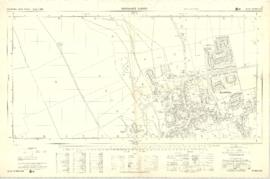
Ordnance Survey Plan SP3003-3103. Bridge St east Colvile Close etc 1971

Ordnance Survey Plan SP3203-3303. 1971 Mt Owen Rd east inc. Gogg Lane, Aston Road to Aston

Ordnance Survey Plan SP3002-3102 1971. Cowleaze Corner Weald to Aston Road

Ordnance Survey Map dated 1922 Grafton to Chimney including villages

Second Edition 1899. Ordnance Survey Map Central Bampton east towards Aston

Second Edition 1899. Ordnance Survey Map Black Bourton, Cowleaze Corner east to Central Bampton
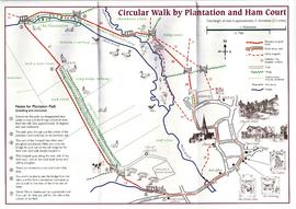
Circular Walk Map - Plantation and Ham Court