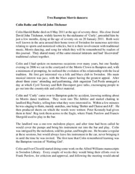
Colin Harold Bathe died on May 8th 2011 at the age of seventy three. His close friend David John Titchener, widely known as Curly, preceded him by just a few months dying at the age of seventy six on January 20th 2011. Both were well known in the area around their home town of Swindon for numerous activities relating to sports and motorised vehicles, but it is their involvement with traditional music, Morris dancing and song for which they will be remembered by Bampton people.
The article gives you far more information about these two men.
The map is pre Inclosure and covers Clanfield, Bampton, Aston and Yelford. The note with the Yelford map says it was from a map of 1624/5. A note at the right side of the page suggests all these details were pulled together from various sources in 1833 which is post Inclosure, which for the Bampton area was 1821. I can't work out what maps were used for the non-Yelford map but it says HHH is Aston 1771.
These three maps are all labelled as 2nd edition 1899. They cover the area Central Bampton, north & south, east nearly to Aston, Black Bourton south to Cowleaze Corner, east to Elephant & Castle in Bridge Street and Mt Owen Rd, west to road going up to Lew now called Station Road. They not only show the buildings but someone has written on in pencil when certain plots were sold and to whom. Interesting to see the clear fish-farming area with the Deanery then called Deanery Farm, Cobb House simply called Vicarage, Churchgate House called Trinity Vicarage. The third vicarage is today called Kilmore House and is almost opposite the East window of St. Mary's. What today is called Bridge Street was then called Mill Street and the mill was just to the left of path to Sandford Field from Bridge St. The legend is the mill wheel was buried in the plot to the left of the brook walking to the field from Bridge St and the tree there today was planted at its centre.
The map was produced in 1921. The first map is has been reused to show where council houses were to be built on the south side of New Road and where the sewerage pipes were to be laid to the sewerage works along the Buckland Road.
Mains sewerage came to Bampton in 1958 after a long struggle and at a cost of £105,000. Miss Marjorie Pollard was the driving force but in the end, it was the death of Horace Morse who emptied the 'night soil' buckets twice a week which made it imperative. Jack Bellinger was the first manager of the sewerage works.
This map was produced in 1922 and shows the field system as well as the parliamentary boundaries as at 1918.
There are many interesting notes written on in pencil. The water tower and gas works along the Aston Road were in existence. The allotment gardens NW of Beam Cottage are labelled as is the gravel pit to the SW of Beam Cottage.
There are no houses to the north of New Road and none to the south of it going east from Bushey Row.
Rushy Weir is shown clearly as is the tow path to the south side of the river Thames.
These four maps were all produce in 1971 and cover
Ordinance Survey Plan SP3002-3102 Weald, Hayway Lane, Weald St, Clanfield Road Ordinance Survey Plan SP3003-3103. Bridge St east to end of houses, north to new school, Colvile Close Ordinance Survey Plan SP3203-3303. 1971 Mt Owen Rd east inc. Gogg Lane, Aston Rod to Aston Ordinance Survey Plan SP3002-3102 1971. Cowleaze Corner, Weald to Aston, north to Horse Shoe PH
Fields, property and farms are all clearly marked.
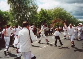
The photographs were all taken by Bob West who carried the cake for the Morris for very many years. They are all of the May Bank Holiday 1997 Morris Dancing
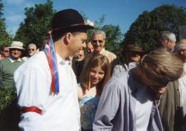
These photographs, all taken by Bob West at the Spring Bank Holiday day of Morris Dancing 2000. All but the last two are Tony Daniels' morris side, (now at 2020 under Craig Godwin). The next to last picture is of Sherbourne Morris and the last picture is Eynsham Morris, both guests of the local side.
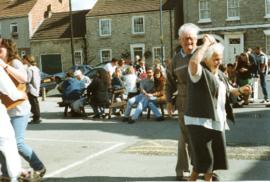
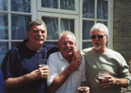
These pictures all taken by Bob West, were taken in 2004. Many are taken in the garden of the Horse Shoe. Some of the people in the pictures include Bob West Ted Poole Billy Main Mary Cook & brother Tommy Tanner Tony Daniels Dave Rose Ann & Francis Shergold Clare Hall Maurice New Jasper Walsh Reg Hall Jim Buckingham Heather David (at Tickhill) Eric Stott Ivy Poole Carole New Liz Rose Roger West
These photographs, all taken by Bob West are of the Tony Daniels' morris side in 2004. People in the pictures include Craig Godwin - who became squire after Tony Margaret Barnes Liz Rose Marian Rouse Bob West Andrew West Brian Rouse Roger West Toby Perry Martin Landray Ted Poole Ivy Poole