Showing 26 results
Archival description
Map 1913 Edition Marsh Lane East incl Weald and Clanfield Road

Map of 1797. Westwell east to Curbridge, Kemscott east to Coat Common plus St Giles Oxford

Map of Bampton Estate at 1789

Map of Weald from Plantation south to Cowleaze Corner, east to the Elephant & Castle

Map with sale of Lower Haddon Farm March 1949

Map with the sale of 5 residential and agricultural properties 1962

Maps of East Half of Bampton 1921

Ordnance Survey Map dated 1922 Grafton to Chimney including villages

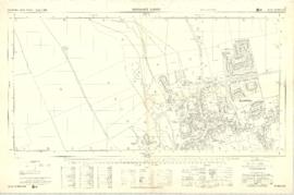
Ordnance Survey Plan SP3002-3102 1971. Cowleaze Corner Weald to Aston Road
Ordnance Survey Plan SP3003-3103. Bridge St east Colvile Close etc 1971
Results 11 to 20 of 26
- « Previous
- 1
- 2
- 3
- Next »