Showing 26 results
Archival description24 results with digital objects Show results with digital objects

Ordnance Survey Plan SP3203-3303. 1971 Mt Owen Rd east inc. Gogg Lane, Aston Road to Aston

Ordnance Survey Plan SP3002-3102 1971. Cowleaze Corner Weald to Aston Road

Four OS maps of Bampton 1971

1974 OS map of Bampton and Aston
Maps by Janet Westman of Brize Norton, Cassington, Eynsham, Gloucestershire, Oxfordshire, Witney
Maps by Janet Westman of Brize Norton, Cassington, Eynsham, Gloucestershire, Oxfordshire, Witney
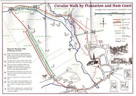
Circular Walk Map - Plantation and Ham Court
Results 21 to 26 of 26
- « Previous
- 1
- 2
- 3