1922 map of Clanfield, Alvescot, Black Bourton, Grafton, Bampton, Aston, Cote & Chimney

Map of Weald from Plantation south to Cowleaze Corner, east to the Elephant & Castle

Bampton maps of 1921

The Lew Estate 1914

1913 map of Weald, west to Marsh Lane on east edge of Clanfield

2nd edition maps of 1899 Bampton, Black Bourton, Mt Owen Road

Pre Inclosure map of Clanfield, Bampton, Aston & Yelford

Map of 1797. Westwell east to Curbridge, Kemscott east to Coat Common plus St Giles Oxford
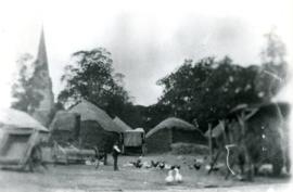
Thatched hayricks

Sales brochure for the Lew House Estate 2019