The map was produced in 1921. The first map is has been reused to show where council houses were to be built on the south side of New Road and where the sewerage pipes were to be laid to the sewerage works along the Buckland Road.
Mains sewerage came to Bampton in 1958 after a long struggle and at a cost of £105,000. Miss Marjorie Pollard was the driving force but in the end, it was the death of Horace Morse who emptied the 'night soil' buckets twice a week which made it imperative. Jack Bellinger was the first manager of the sewerage works.
This map was produce for the sale of the Lew Estate in 1914. There used to be a Post Office and a school in Lew, both shown on this map between University Farm and Holy Trinity Church on the main road.
This map is from 1913 and covers the area from Marsh Lane on the eastern edge of Clanfield west across Weald. However, all of Bridge Street, half the Talbot Inn, the west side of the Market Square, the South side of Church Street and Church View are all in Weald and they are not shown here, possibly because the map was for agricultural purposes. There are some very interesting notes added in pencil.
These three maps are all labelled as 2nd edition 1899. They cover the area Central Bampton, north & south, east nearly to Aston, Black Bourton south to Cowleaze Corner, east to Elephant & Castle in Bridge Street and Mt Owen Rd, west to road going up to Lew now called Station Road. They not only show the buildings but someone has written on in pencil when certain plots were sold and to whom. Interesting to see the clear fish-farming area with the Deanery then called Deanery Farm, Cobb House simply called Vicarage, Churchgate House called Trinity Vicarage. The third vicarage is today called Kilmore House and is almost opposite the East window of St. Mary's. What today is called Bridge Street was then called Mill Street and the mill was just to the left of path to Sandford Field from Bridge St. The legend is the mill wheel was buried in the plot to the left of the brook walking to the field from Bridge St and the tree there today was planted at its centre.
The map is pre Inclosure and covers Clanfield, Bampton, Aston and Yelford. The note with the Yelford map says it was from a map of 1624/5. A note at the right side of the page suggests all these details were pulled together from various sources in 1833 which is post Inclosure, which for the Bampton area was 1821. I can't work out what maps were used for the non-Yelford map but it says HHH is Aston 1771.
This map of 1797 shows the Bampton Hundred and the fields. There is also a map of St Giles in Oxford at this time. Today, Kelmscott is spelt with two Ts but on this map it has one.
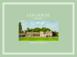
Lew House and the attached estate was put on the market in 2019. It could all be sold as one item or lots of land could be purchased separately. This Knight Frank sales brochure gives all the details.
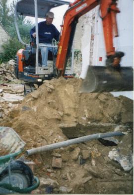
When work was done at Castle View, which at one time was Castle View farmhouse, a well was found. When the work to modernise was completed, the well was covered over and is now under part of the kitchen.
This map shows the Bampton Estates at 1789. This is before the fields were enclosed and the names of the people who farmed the strips or the name of the field area are on the map. The Quies fields are each side of the Bampton to Brize Norton road, just north of what is now Hobbs Buildings. The Clanfield to Bampton road is showing top to bottom on the map whereas it really runs east west, so you need to get your head around that, literally. What we now call Welcome Way is called Wiltham Way - it runs south from Cowleaze Corner into Weald. Weald Common Meadow was south of what we now think of as the area containing the two Bampton Business Parks. The Bampton to Buckland road is showing going left to right on the map when it actually runs NW to SE; it had a turnpike.