Previsualizar a impressão Fechar
Mostrar 26 resultados
Descrição arquivística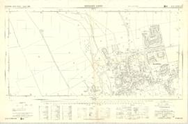
Ordnance Survey Plan SP3003-3103. Bridge St east Colvile Close etc 1971

Ordnance Survey Plan SP3203-3303. 1971 Mt Owen Rd east inc. Gogg Lane, Aston Road to Aston

Ordnance Survey Plan SP3002-3102 1971. Cowleaze Corner Weald to Aston Road

Four OS maps of Bampton 1971

1974 OS map of Bampton and Aston
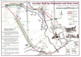
Circular Walk Map - Plantation and Ham Court
Resultados 21 a 26 de 26
- « Anterior
- 1
- 2
- 3